|
Last updated
15/01/2018 |
|
|
|
Walk No |
Date |
Area |
Walk details |
Weather |
Miles |
Ft Ascent |
Walkers |
|
154 |
02/01/17 |
Cheshire |
Macclesfield
Forest and Forest Chapel |
Sunny |
7 |
1162 |
16 |
|
155 |
15/01/17 |
Cheshire |
Prestbury and
Mottram Hall |
Rain |
6 |
394 |
6 |
|
156 |
29/01/17 |
Cheshire |
Redesmere and
Capesthorn Hall |
Overcast |
8 |
451 |
9 |
|
157 |
12/02/17 |
Cheshire |
Danebridge and
Hamerton Knowle |
Snow showers,
cold wind |
5 |
899 |
5 |
|
158 |
12/03/17 |
Cheshire |
Higher
Hurdsfield and Rainow. |
Sunny periods |
6 |
1224 |
14 |
|
159 |
26/03/17 |
Peak District |
Monsal Head
and Millers Dale |
Sunny |
6 |
1562 |
15 |
|
160 |
09/04/17 |
Cheshire |
Danebridge and
Gradbach |
Sunny periods |
9 |
1841 |
16 |
|
161 |
23/04/17 |
Cheshire |
Lindow Common
and Styal Mill |
Sunny periods |
8 |
693 |
5 |
|
162 |
07/05/17 |
Cheshire |
Prestbury and
Butley Town |
Sunny periods |
7 |
439 |
15 |
|
163 |
04/06/17 |
Cheshire |
Disley and
Marple Ridge |
Sunny periods
& showers |
7 |
758 |
12 |
|
164 |
18/06/17 |
Cheshire |
Alderley Edge and Nether Alderley |
Sunny |
7 |
|
8 |
|
165 |
02/07/17 |
Cheshire |
Shakerley Mere
and Lower Peover |
Sunny periods |
7 |
139 |
8 |
|
166 |
16/07/17 |
Cheshire |
Rainow
Scarecrow Walk from Bollington |
Sunny periods |
7 |
1520 |
7 |
|
167 |
13/08/17 |
Cheshire |
Over Peover,
Ollerton Hall and Peover Hall |
Sunny periods |
7 |
106 |
11 |
|
168 |
27/08/17 |
Cheshire |
Whaley Bridge
and Whaley Moor |
Sunny periods |
7 |
879 |
12 |
|
169 |
10/09/17 |
Cheshire |
Adlington and
Wood Lanes |
Overcast |
7 |
313 |
5 |
|
170 |
24/09/17 |
Peak District |
Whaley Bridge
and Taxal |
Sunny periods |
7 |
665 |
5 |
|
171 |
08/10/17 |
Peak District |
Ashford in the
Water and Monsal Head |
Sunny periods |
7 |
1125 |
11 |
|
172 |
22/10/17 |
Cheshire |
Ashley, Mobberley and the HS2 |
Drizzle at
first then overcast |
8 |
442 |
3 |
|
173 |
19/11/17 |
Cheshire |
Rainow and
Lamaload |
Sunny periods |
7 |
|
7 |
|
174 |
17/12/17 |
Peak District |
Castleton and
Hope with Broken Cross Walkers |
Mostly drizzle |
8 |
770 |
3 |
|
175 |
31/12/17 |
Cheshire |
Macclesfield
Forest and Forest Chapel |
Sunny periods |
7 |
1308 |
10 |
| |
|
|
|
|
|
|
|
| |
|
|
|
|
|
|
|
| |
|
|
|
|
|
|
|
| |
|
|
|
|
|
|
|
|
|
|
|
Walk 154 - 02/01/17 Macclesfield Forest
and Forest Chapel with Broken Cross Walkers |
| Area |
Cheshire |
Walking time |
3
hours |
Average speed |
|
| Walk |
Macclesfield Forest and Forest Chapel with Broken
Cross Walkers |
Minimum altitude |
|
Maximum altitude |
|
| Start
from |
Leathers Smithy, Langley |
Altitude loss |
|
Altitude gain |
|
| Weather |
Sunny |
Distance |
7
miles |
|
|
| Map |
Explorer 268 |
Information from
Viewranger app on my Samsung S7 phone |
|
Route - Leathers
Smithy, Nessit Hill - Standing Stone - Forest Chapel -
Charity Lane - Leathers Smithy |
|
|
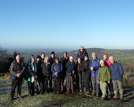
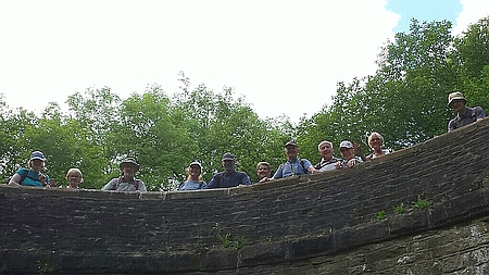
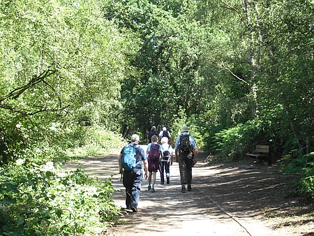
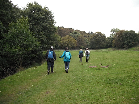
Sixteen of us set off from Leathers Smithy, Langley on a
lovely sunny day. We walked around Ridgegate Reservoir and
then up through the forest to Nessit Hill where we stopped
for a coffee break. Fine views across Macclesfield and the
Cheshire Plain. We continued along the track to Standing
Stone and then along the lane to Forest Chapel where we
stopped for lunch. Afterwards the walk up an icy Charity
Lane caused a few problems and then it was into the forest
and down the track and out onto the lane which took us
back to the Leathers Smithy. Our group consisted of Kati,
Pat G, Dave G, Wendy, Hans, Ruth, Ray, Rob, Alec,
Christine J, Maureen, Derek, Karen, Alison, Christine and
myself. An enjoyable walk on a nice sunny day.
|
 |
|
On Nessit Hill on our
first walk of 2017, from the left myself, Pat G, Dave G,
Alec, Christine A, Ray, Alison, Derek, Maureen, Christine
J, Ruth, Wendy, Hans, Kati, Karen and Derek |
|
|
 |
|
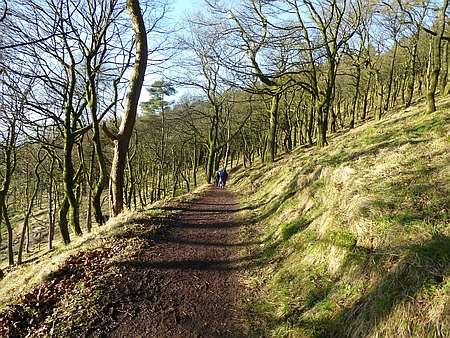
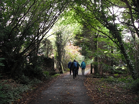
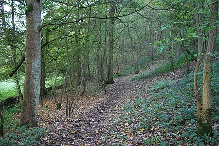
Following the track
through Macclesfield Forest |
|
|
|
 |
|
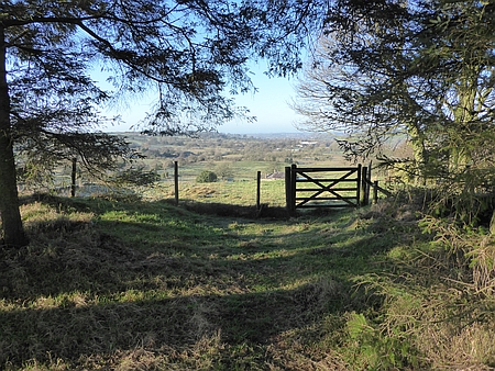
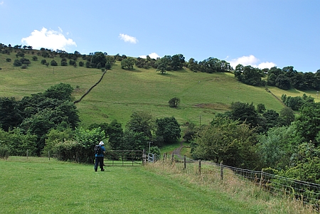
Looking out from the
Forest over Langley |
|
|
 |
|
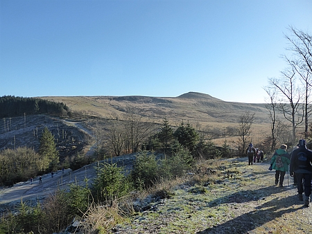
Shutlingsloe in the distance |
|
|
|
|
|
|
|
|
|
|
|
|
|
|
|
|
|
|
|
|
|
|
|
|
|
|
| |
|
| |
|
|
| |
|
|
|
|
Walk 155 - 15/01/17 Prestbury and
Mottram Hall with Broken Cross Walkers |
| Area |
Cheshire |
Walking time |
3
hours |
Average speed |
|
| Walk |
Prestbury and Mottram Hall with Broken Cross Walkers |
Minimum altitude |
|
Maximum altitude |
|
| Start
from |
Prestbury |
Altitude loss |
|
Altitude gain |
|
| Weather |
Rain |
Distance |
5.80
miles |
|
|
| Map |
Explorer 268 |
Information from
Viewranger app on my Samsung S7 phone |
|
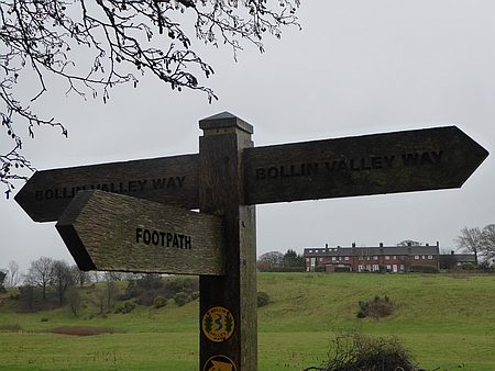
Route - Prestbury -Bollin
Valley Way - Mottram Hall - Hunters Pool - Legh Hall -
Spittle House - Prestbury |
|
|
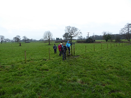
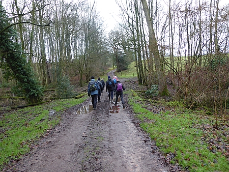
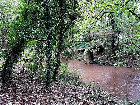
Six of us set off from Prestbury on a rather wet day, we
followed the Bollin Valley Way north as far as Mottram
Hall and then across the fields to Hunters Pool and Legh
Hall. The rain showed no signs of easing off so we
shortened the walk by returning back across the fields to
Spittle House and then back into Prestbury. Thanks to
Christine, Kati, Maureen, Derek and Chris R for joining me
on this rather wet day.
|
|
|
 |
|
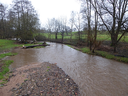
The River Bollin was
rather swollen with all the recent rain |
|
|
| |
|
|
| |
|
 |
|
We
are on the Bollin Valley Way |
|
|
| |
|
|
|
|
|
|
| |
|
| |
|
|
| |
|
|
|
|
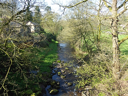
Walk 156 - 29/01/17 Redesmere and
Capesthorne Hall with Broken Cross Walkers |
| Area |
Cheshire |
Walking time |
3
hours |
Average speed |
|
| Walk |
Redesmere and Capesthorne Hall with Broken Cross
Walkers |
Minimum altitude |
|
Maximum altitude |
|
| Start
from |
Redesmere |
Altitude loss |
|
Altitude gain |
|
| Weather |
Overcast |
Distance |
7.92
miles |
|
|
| Map |
Explorer 268 |
Information from
Viewranger app on my Samsung S7 phone |
|
Route - Redesmere -
Heskey Moss Wood - Northwood Farm - Siddington -
Capesthorne - Redesmere |
|
| Nine
of us set off from Redesmere across the fields to Henshaw
Farm and then through Heskey Wood to Moss Wood. Next it
was through Northwood Farm and across the A34 and then
north through Siddington to Capesthorne Hall, once past
the hall we crossed the A34 again and walked alongside
Redesmere and back to the car park.. Our group consisted
of myself David, Christine, Kati, Hans, Ray, Sue P,
Chris R and Maureen and Derek. Special thanks to Maureen
and Derek for leading us on this delightful walk which we
managed to complete before the rain arrived. |
|
|
 |
|
One of the many stiles
on the fields near Capesthorne |
|
|
| |
|
|
| |
|
 |
|
A
muddy track through Heskey Wood |
|
|
 |
|
In
the grounds of Capesthorne Hall |
|
|
|
| |
|
|
| |
|
|
|
|
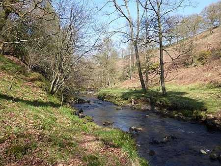
Walk 157 - 12/02/17 Dane Bridge and
Wild Boar Inn |
| Area |
Cheshire |
Walking time |
3
hours |
Average speed |
|
| Walk |
Dane
Bridge and Wild Boar Inn |
Minimum altitude |
|
Maximum altitude |
|
| Start
from |
Dane
Bridge |
Altitude loss |
|
Altitude gain |
|
| Weather |
Snow
showers, cold wind and the occasional blue sky |
Distance |
5
miles |
|
|
| Map |
Explorer 268 |
Information from
Viewranger app on my Samsung S7 phone |
|
Route - Danebridge -
Allmeadows - Hammerton Knowle Farm - Wild Boar Inn -
Hamerton Farm - Danebridge |
|
| Five
hardy walkers set off from Danebridge and headed across
the fields towards Allmeadows. There was a bitter wind and
light snow blowing off the fields giving an unreal
situation of snow flurries and blue skies. After
Allmeadows we followed the lane and headed up to
Hammerston Knowle Farm. At this point on the windswept
hillside we decided to head back by a shorter route and
once we had passed the Wild Boar Inn we followed the track
across to Hammerton Farm at Wincle and then back across
the fields and down to Danebridge. Even the Fish Farm was
closed due to the conditions. |
|
Thanks to Christine.
Kati, Maureen and Derek for joining me on this windblown
expedition. |
| |
 |
|
Heading for Allmeadows,
blowing snow in the air not visible on the photo |
| |
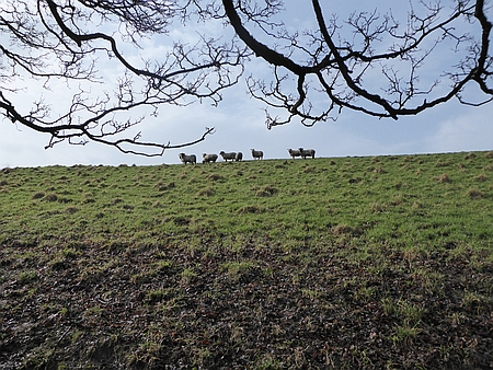 |
|
Sheep above us on the
hillside |
|
 |
|
A
sheltered wood |
|
|
 |
|
An
early lunch in a sheltered spot near Allmeadows |
|
|
|
|
|
|
|
|
|
|
|
|
|
|
|
|
|
|
|
|
| |
|
| |
|
|
| |
|
|
|
|
Walk 158
- 12/03/17 Higher Hurdsfield and Rainow |
| Area |
Cheshire |
Walking time |
3
hours |
Average speed |
|
| Walk |
Higher
Hurdsfield and Rainow |
Minimum altitude |
|
Maximum altitude |
|
| Start
from |
Higher
Hurdsfield |
Altitude loss |
|
Altitude gain |
|
| Weather |
Sunny
periods |
Distance |
6
miles |
|
|
| Map |
Explorer 268 |
Information from
Viewranger app on my Samsung S7 phone |
|
Route - Higher
Hurdsfield - Cliff Hill - Marsh Farm - Brink Farm - Walker
Barn - Gulshaw Hollow - Tower Hill - Kerridge End - Higher
Hurdsfield |
|
|
Fourteen of us set off from Higher Hurdsfield and walked
across Cliff Hill and up to Marsh Farm, after crossing the
fields we followed the lane up to Buxton Road and then a
rather muddy path took us past the forest and onto firmer
ground. A pleasant track took us along the hillside
through Brink Farm and down to Walker Barn. Across the
road another track took us down to Gulshaw Hollow where we
stopped for lunch in a sunny and sheltered spot. The track
took us towards Rainow and we crossed the road near Tower
Hill and across onto Kerridge Hill with more mud to
negotiate. We eventually arrived at Kerridge End and an
easy walk took us along the road and back to our start
point at Higher Hurdsfield. Thanks to Christine, Kati, Pat
G, Dave G, Maureen, Derek, Sue P, Ros, Sheila, Chris R,
Wendy, Hans, and Chris J for joining me on this walk. My
apologies for the mud. |
|
|
 |
|
Heading along the
trackway towards Brink Farm |
|
|
| |
|
|
| |
|
 |
|
Great views over to White Nancy |
 |
|
Lunch break in Gulshaw Hollow |
|
|
|
| |
|
|
| |
|
|
|
|
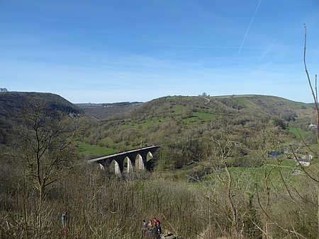
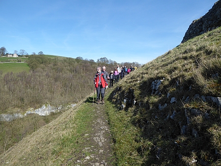
Walk 159 - 26/03/17 Monsal Head and
Millers Dale |
| Area |
Peak
District |
Walking time |
3
hours |
Average speed |
|
| Walk |
Monsal
Head and Millers Dale |
Minimum altitude |
|
Maximum altitude |
|
| Start
from |
Ravenstor near Litton Mill |
Altitude loss |
|
Altitude gain |
|
| Weather |
Sunny |
Distance |
6
miles |
|
|
| Map |
OS
White Peak OL24 |
Information from
Viewranger app on my Samsung S7 phone |
|
Route Ravenstor -
Litton Mill - Cressbrook Mill - Monsal Head - Monsal Trail
- Ravenstor. |
|
|
Fifteen of us set off on a nice sunny day from the
roadside parking area beneath Ravenstor, we passed through
Litton Mill and down the path alongside the River Wye.
After several muddy and flooded parts we arrived at
Cressbrook Mill and then followed the lane alongside the
river and up to Monsal Head where we stopped for lunch.
Afterwards we descended down to the Monsal Trail and
walked across the Viaduct and followed the Trail as far as
the first tunnel where we took to the hillside path which
climbs high above the river. Some great views down to the
river below with several tricky parts which required
careful walking on the steep hillside. Once back on the
Trail we followed this for several miles and then
descended down across the river and back to the cars along
the lane. Thanks to Christine, Anita, Kati, Doreen, Ray,
Maureen, Derek, Ros, Mike, Alec, Christine J, Chris R,
Wendy and Alan for joining me on this walk |
|
|
 |
|
Looking down on the
Monsal Viaduct |
|
|
 |
|
Looking down on Litton
Mill |
| |
|
 |
|
One
of the tricky parts where the river had flooded the path |
|
|
 |
|
The
hillside path high above the river |
|
|
|
|
|
|
|
|
|
|
|
|
|
|
|
|
|
|
|
|
|
|
|
|
| |
|
| |
|
|
| |
|
|
|
|
Walk 160 -
09/04/17 Danebridge and Gradbach |
| Area |
Cheshire/ Staffordshire |
Walking time |
4
hours |
Average speed |
|
| Walk |
Danebridge and Gradbach |
Minimum altitude |
|
Maximum altitude |
|
| Start
from |
Danebridge |
Altitude loss |
|
Altitude gain |
|
| Weather |
Sunny
periods |
Distance |
8.50
miles |
|
|
| Map |
OS
White Peak OL24 |
Information from
Viewranger app on my Samsung S7 phone |
|
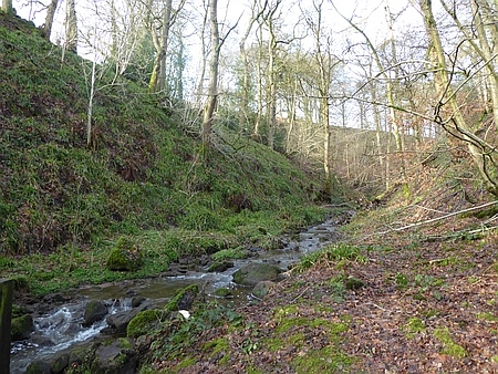
Route Danebridge -
Gradbach - Heild End Farm - Blaze Farm - Allmeadows -
Wincle - Danebridge |
|
|
Sixteen of us set off from Danebridge and followed the
Dane Valley Way to Gradbach, we climbed up out of the
valley and across the Moor to Heild End Farm. Once across
the A54 we descended into Wildboarclough calling into
Blaze Farm for Ice Creams. Then it was along the lane past
Allmeadows and back through Wincle to Danebridge. The walk
ended with refreshments at Wincle Brewery and some of us
purchased some trout from Daanebridge Fisheries. A longer
walk than planned and thanks to Christine, Kati, Anita,
Doreen, Carol, Pat G, Maureen, Derek, Wendy, Hans, Ros,
Mike, Sheila, Chris R and Ray for joining me on this walk. |
|
|
 |
|
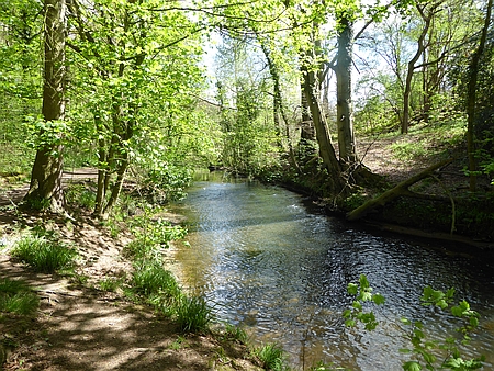
River Dane near
Gradbach |
|
|
| |
|
|
| |
|
 |
|
River Dane at Danebridge |
|
|
 |
|
Some
of our group as we set off after lunch |
|
|
|
|
| |
|
| |
|
|
| |
|
|
|
|
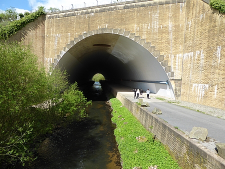
Walk 161 - 23/04/17 Lindow Moss and
Styal Woods |
| Area |
Cheshire |
Walking time |
3½
hours |
Average speed |
|
| Walk |
Lindow
Moss and Styal Woods |
Minimum altitude |
|
Maximum altitude |
|
| Start
from |
Car
Park Lindow Common |
Altitude loss |
|
Altitude gain |
|
| Weather |
Sunny
periuods |
Distance |
7.95
miles |
|
|
| Map |
Explorer 268 |
Information from Viewranger app on my Samsung S7 phone |
|
Route Lindow Common -
North Cheshire Way - Styal Woods - The Carrs - Lindow
Common |
|
| Five
of us set off from the car park and headed across Lindow
Moss and onto the North Cheshire Way which we followed
alongside the Airport Runway, after a bit of plane
spotting we continued on along the path and through
Styal Woods where we stopped for lunch by the River Bollin,
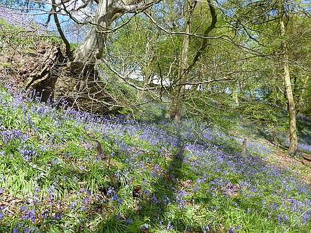
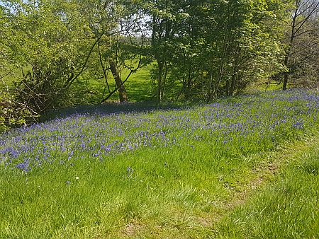
the bluebells were out and there were some great views in
the woods. Afterwards we continued along the North
Cheshire Way to Styal Mill where we stopped for ice creams
and then it was along the path to the Carrs and back up
the lane to the car park. Thanks to Christine, Anita, Rob
and Carolyn for joining me on this walk. |
|
|
 |
|
The massive tunnel
carrying the River Bollin under the Manchester Airport
Runway. The roadway can be used for emergency vehicles to
access both side of the runway. |
|
|
 |
|
Bluebells in Styal
Woods |
| |
|
 |
|
A
pool on Lindow Moss |
|
|
 |
|
The
River Bollin in Styal Woods |
|
|
|
|
|
|
|
|
|
|
|
|
|
|
|
|
|
|
| |
|
| |
|
|
| |
|
|
|
|
Walk
162 - 07/05/17 Prestbury and Butley Town |
| Area |
Cheshire |
Walking time |
3
hours |
Average speed |
|
| Walk |
Prestbury and Butley Town |
Minimum altitude |
|
Maximum altitude |
|
| Start
from |
Riverside Park Beech Lane Macclesfield |
Altitude loss |
|
Altitude gain |
|
| Weather |
Sunny
periods |
Distance |
7
miles |
|
|
| Map |
Explorer 268 |
Information from
Viewranger app on my Samsung S7 phone |
|
Route - Riverside Park
- Bollin Valley Way - Prestbury - Butley Town - Dumbah
Hollow - Middlewood Way - Riverside Park |
|
|
Fifteen of us set off from the Riverside Park in
Macclesfield, we followed the Bollin Valley Way to
Prestbury and after passing through the village we
followed the lane out of the village for a short and then
it was across to Butley Town using the field paths, after
lunch we carried on through some charming areas that we
had not visited before then it was along Dumbah Hollow and
onto the Middlewood Way and back to Macclesfield. Thanks
to Anita, Doreen, Wendy, Chris R, Pat, Dave, Sue P, Alan,
Sheila, Margeret, Ray, Maureen, Derek, and Susanna for
joining me on this walk. |
|
|
| |
|
|
|
|
| |
|
|
| |
|
|
 |
|
The
bluebells are out |
|
|
|
| |
|
|
| |
|
|
|
|
Walk 163
- 04/06/17 Disley and Marple Ridge |
| Area |
Cheshire |
Walking time |
3½
hours |
Average speed |
|
| Walk |
Disley
and Marple Ridge |
Minimum altitude |
|
Maximum altitude |
|
| Start
from |
Disley |
Altitude loss |
|
Altitude gain |
785 ft |
| Weather |
Sunny
periods and showers |
Distance |
7
miles |
|
|
| Map |
OS
Dark Peak OL1 |
Information from
Viewranger app on my Samsung S7 phone |
|
Route - Disley -
Ladybrook Interest Trail - Macclesfield Canal -
Windlehurst Hall - Marple Ridge - Peak Forest Canal -
Disley |
|
|
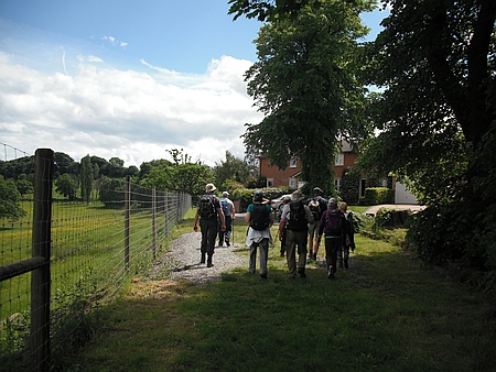
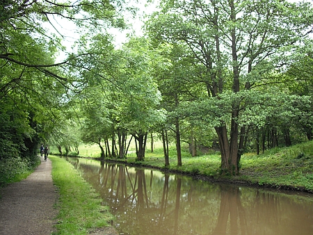
Twelve of us set off from Disley along the edge of Lyme
Park to Elmerhurst Cottage and then down to the Ladybrook
Interest Trail where a heavy shower forced us to take
shelter, once that was past the weather brightened and we
had good weather fore the rest of the walk. After walkingh
along the trail we came to the Macclesfield Canal and then
it was along the towpath to Windlehurst Hall where we
stopped for lunch. Then it was across the fields and after
losing the path we emerged onto Marple Ridge with some
great views all around. We descended down the track to the
Peak Forest Canal and then headed south east along the
towpath back to Disley. An interesting walk and many
thanks to Christine, Carol, Alec, Christine J, Maureen,
Derek, Chris R, Sue P, Alan, Wendy and Ray for joining me
on this walk |
|
|
 |
|
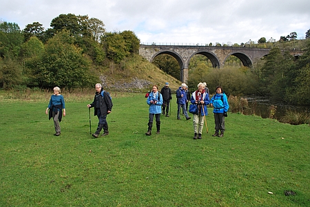
Our group on the Canal
Bridge. Thanks to Chris Ratcliffe for the photo. |
|
|
| |
|
|
| |
|
|
 |
|
Walking past Windlehurst Hall |
|
|
 |
|
On
the Macclesfield Canal Towpath |
|
|
|
|
|
|
|
| |
|
|
| |
|
|
|
|
Walk 164
18/06/17 - Alderley Edge and Nether Alderley |
| Area |
Cheshire |
Walking time |
3
hours |
Average speed |
|
| Walk |
Alderley Edge and Nether Alderley |
Minimum altitude |
|
Maximum altitude |
|
| Start
from |
The
Wizard, Alderley Edge |
Altitude loss |
|
Altitude gain |
|
| Weather |
Sunny
periods |
Distance |
7
miles |
|
|
| Map |
Explorer 268 |
Information from
Viewranger app on my Samsung S7 phone |
|
Route - Wizard -
Finlow Hill - Haymans Farm - Hocker Lane - Jaymans Farm -
Painters Eye - Yarwoods Farm - Nether Alderley Church -
Wizard |
|
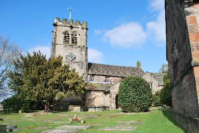
| Eight
of us set off from the Wizard along the lane towards
Finlow Hill and then using field paths we passed Haymans
Farm and along Hocker Lane and past Jaymans farm and
Painters Eye. After crossing the A34 we passed Yarwoods
Farm and Heawood Farm and then to the beautiful St Marys
Church at Nether Alderley. Our route then took us up
Bradford Lane and back to the Wizard. Maureen, Derek,
Wendy, Christine, Chris R, Anita and Pat G were on the
walk and special thanks to Maureen and Derek for leading
this excellent walk. |
|
|
| |
|
|
|
|
| |
|
|
| |
|
|
 |
|
St
Marys Church Nether Alderley |
|
|
|
|
|
|
|
|
|
|
|
|
|
| |
|
|
| |
|
| |
|
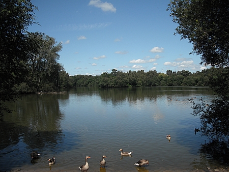
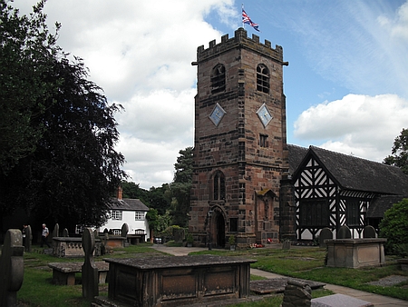
Walk 165
- 02/07/17 Shakerley Mere and Lower Peover with
Broken Cross Walkers |
| Area |
Cheshire |
Walking time |
3
hours |
Average speed |
|
| Walk |
Shakerley Mere & Lower Peover with Broken Cross
Walkers |
Minimum altitude |
|
Maximum altitude |
|
| Start
from |
Shakerley Mere |
Altitude loss |
|
Altitude gain |
139 ft |
| Weather |
Sunny
periods |
Distance |
7
miles |
|
|
| Map |
|
Information from
Viewranger app on my Samsung S7 phone |
|
Route - Shakerley Mere
- Hulme Farm - Lower Peover - Fox Covert - Dams Lane
- Shakerley Mere |
|
| Eight
of us set off from Shakerley Mere and after walking
alongside the Mere headed up Hulme Hall Lane and then
across the fields to Hulme Hall Farm and then onward
to Lower Peover where we stopped for lunch in the
Churchyard of St Oswalds Church which has a history dating
back to 1269. Afterwards we headed south across the fields
past and eventually onto Dams Lane and then back to the
Mere where we enjoyed a refreshing ice cream. Many thanks
to Christine, Carol, Ray, Wendy, Alan, Sue and Chris R for
joining me on this walk. |
|
|
 |
|
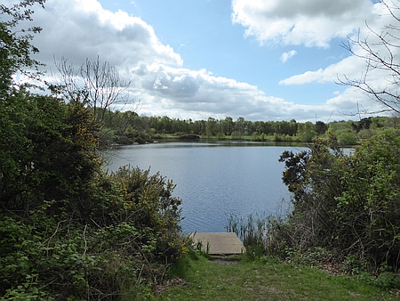
The path around
Shakerley Mere |
|
|
| |
|
|
| |
|
|
 |
|
Shakerley Mere |
|
|
 |
|
Lower Peover Church |
|
| |
|
|
| |
|
| |
|
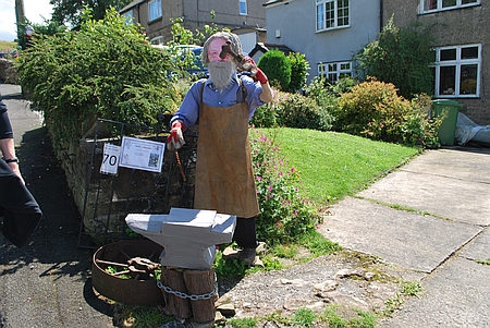
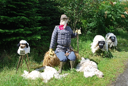
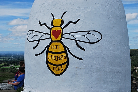
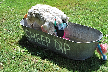
Walk 166 -16/07/17 Rainow Scarecrow Walk
from Bollington |
| Area |
Cheshire |
Walking time |
4 hours |
Average speed |
|
| Walk |
Rainow
Scarecrow Walk from Bollington |
Minimum altitude |
|
Maximum altitude |
|
| Start
from |
Bollington |
Altitude loss |
|
Altitude gain |
1520 ft |
| Weather |
Sunny |
Distance |
7 miles |
|
|
| Map |
Explorer 268 |
Information from
Viewranger app on my Samsung S7 phone |
|
Route - Bollington -
Berristall Hall - Harrop Fold Farm - Rainowlow - Rainow -
Kerridge Hill - White Nancy - Bollington |
|
| Seven
of us set off from Bollington and followed the lane to the
Gritstone Trail which we followed to Berristall Hall, a
hillside path then took us along the valley side to
Further Harrop Farm and then field paths took us across to
a hillside track near Billinge Hill where we stopped for
lunch. Afterwards we followed the path through Rainowlow
into Rainow where we spent some time admiring the various
Scarecrows in the Festival. The theme this year was
occupations and there were many amusing Scarecrows. After
we had viewed a considerable number we set off across the
valley and climbed the very steep path up onto Kerridge
Hill ridge and then it was along the ridge pausing to
examine White Nancy in its new livery of the Manchester
Bee which was in memory of the people who lost their lives
in the recent Manchester bombing. A steep descent
took us down through the woods and then across the fields
and back into Bollington. Many thanks to Christine, Wendy,
Chris R, Karen, Ray and Andrew for joining me on this walk |
|
|
 |
|
A blacksmith at work |
|
|
 |
|
"While shepherds watch
there flock by night" and day as well |
| |
 |
|
The Manchester Bee on
White Nancy |
| |
| |
| |
| |
|
|
 |
|
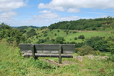
A
bench with a view, looking across to Billinge Hill |
|
|
 |
|
I
like the snorkel and the wellie's |
|
|
 |
|
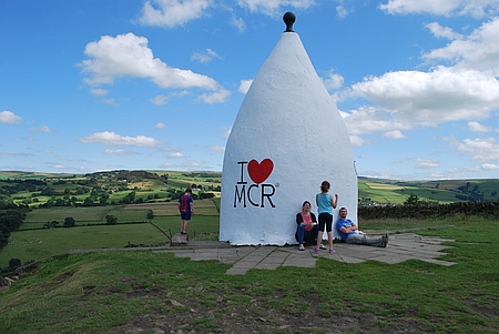
Heading towards Kerridge Hill, it's a steep climb up.
|
|
|
 |
|
White Nancy |
|
|
|
|
|
|
|
|
|
| |
|
|
| |
|
| |
|
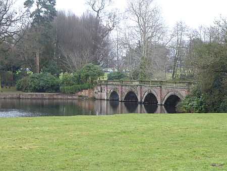
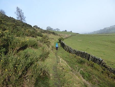
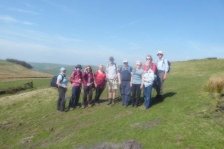
Walk 167 - 13/08/17 Over Peover , Ollerton Hall and
Peover Hall |
| Area |
Cheshire |
Walking time |
3½
hours |
Average speed |
|
| Walk |
Over
Peover , Ollerton Hall & Peover Hall |
Minimum altitude |
|
Maximum altitude |
|
| Start
from |
Radbrooke Hall Layby A50 |
Altitude loss |
|
Altitude gain |
|
| Weather |
Sunny
periods |
Distance |
7
miles |
|
|
| Map |
|
Information from
Viewranger app on my Samsung S7 phone |
|
Route - Radbrooke Hall
- Ollerton Hall - Bowden Bank Farm - Peover Hall -
Radbrook Hall |
|
|
Eleven of us set off from Radbrooke Hall and followed the
tracks and field paths across to Ollerton Hall, after a
coffee stop we carried on down the lane and past Bowden
Bank Farm and then along the track where we stopped for
lunch. Afterwards we took the field paths across to the
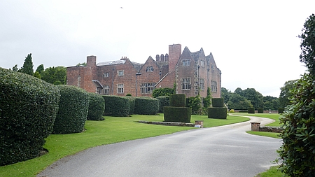
beautiful Peover Hall, A Grade II listed Elizabethan
family house dating from 1585. We then carried on along
the track to the excellent Whipping Stocks Inn where we
stopped for more refreshments before carrying on along the
road back to the start. Thanks to Christine, Carol, Pat,
Maureen, Derek, Ray, Chris R, Jo C, Mike and Ros for
joining me on this lovely flat walk. |
|
|
| |
|
|
|
|
| |
|
Information on Wikipedia about Peover Hall |
| |
|
|
|
|
 |
|
Peover Hall |
|
|
|
|
|
|
|
|
|
|
|
| |
|
|
| |
|
| |
|
Walk 168 - 27/08/17 Whaley Bridge and
Whaley Moor |
| Area |
Derbyshire |
Walking time |
3
hours |
Average speed |
|
| Walk |
Whaley
Bridge and Whaley Moor |
Minimum altitude |
|
Maximum altitude |
|
| Start
from |
Whaley
Bridge |
Altitude loss |
|
Altitude gain |
879 ft |
| Weather |
Sunny
periods |
Distance |
7
miles |
|
|
| Map |
Ordnance Survey OS OL1 Dark Peak area |
Information from
Viewranger app on my Samsung S7 phone |
|
Route - Whaley Bridge
- Toddbrook Reservoir - Cliff - Moorside - Redmoor Farm -
Furness Vale - Peak Forest Canal - Whaley Bridge |
|
|
Twelve of us set off from Whaley Bridge and followed the
lane up past Toddbrook Reservoir and then field tracks and
paths took us up the hillside past Cliff until we reached
the high point of the walk which was the old Moorside
Hotel. Lunch was taken on the hillside with some great
views over to the west with Manchester on our right and
keen eyed ones amongst us managed to spot the Liverpool
Cathedral on the skyline. After lunch we followed the
field paths and tracks past Redmoor Farm and then down to
Furness Vale where we joined the Peak Forest Canal for the
walk back to Whaley Bridge. Thanks to Christine, Anita,
Wendy, Chris J, Alec, Ray, Chris R, Alison, Ian,
Karen and Kati for joining me on this walk. |
|
|
| |
|
|
|
|
| |
|
|
| |
|
|
|
|
 |
|
Great views on this walk |
|
|
|
|
|
|
|
|
|
|
|
| |
|
|
| |
|
| |
|
Walk 169- 10/09/17 Adlington and Wood Lanes |
| Area |
Cheshire |
Walking time |
3
hours |
Average speed |
|
| Walk |
Adlington and Wood Lanes |
Minimum altitude |
|
Maximum altitude |
|
| Start
from |
Adlington |
Altitude loss |
|
Altitude gain |
|
| Weather |
Sunny
periods |
Distance |
7
miles |
|
|
| Map |
Explorer 268 |
Information from
Viewranger app on my Samsung S7 phone |
|
Route - Adlington -
Hope Green Hope Lane - Wood Lane - Macclesfield Canal -
Bartons Clouigh - Harrop Green Farm - Adlington |
|
| Five
of us set off from Adlington across the fields and
past the Golf Centre to Hope Green. We crossed the main
road and followed the tracks and paths across to the
Macclesfield Canal where we stopped for lunch. Afterewards
we followed the canal southwards and then through Bartons
Clough and Harrop Green Farm and back to the start at
Adlington. Thanks to Christine, Kati, Chris R and Anita for
joining me on this walk. |
|
|
| |
|
|
|
|
| |
|
|
| |
|
|
|
|
 |
|
Heading towards the canal |
|
|
|
|
|
|
|
|
|
|
|
| |
|
|
| |
|
| |
|
Walk 170
- 24/09/17 Peak District Whaley Bridge and Taxal |
| Area |
Peak
District |
Walking time |
3
hours |
Average speed |
|
| Walk |
Peak
District Whaley Bridge and Taxal |
Minimum altitude |
|
Maximum altitude |
|
| Start
from |
Whaley
bridge |
Altitude loss |
|
Altitude gain |
1125
ft |
| Weather |
Overcast |
Distance |
6.65
miles |
|
|
| Map |
OS The
Peak District OL24 |
Information from
Viewranger app on my Samsung S7 phone |
|
Route - Whaley Bridge
- Taxal - Midshires Way - Goyt Valley - Shallcross Wood -
Whaley Bridge |
|
| Five
of us set off from Whaley Bridge through the park and
across the fields to Taxal we arrived at Taxal Church and
then followed the Midshires Way along the hillside and
eventually down to the dam at the end of Fernilee
Reservoir. Once across the dam we followed the track down
to the River Goyt stopping for lunch on the hillside.
Afterwards we continued along the riverside path through
Shallcross Woods and back into Whaley Bridge. Many thanks
to Christine, Pat G, Kati and Chris R for joining me on
this walk. |
|
|
 |
|
Walking alongside the
River Goyt |
|
|
| |
|
|
| |
|
|
 |
|
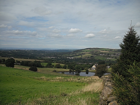
Fernilee Reservoir |
|
|
 |
|
Autumn is here |
|
|
|
|
|
|
|
| |
|
|
| |
|
| |
|
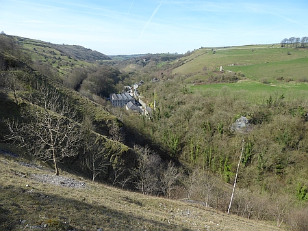
Walk 171 - 08/10/17 Ashford in the Water and Maonsal
Head |
| Area |
Peak
District |
Walking time |
4 hours |
Average speed |
|
| Walk |
Ashford in the Water and Monsal Head |
Minimum altitude |
|
Maximum altitude |
|
| Start
from |
Ashford in the Water |
Altitude loss |
|
Altitude gain |
1654 ft |
| Weather |
Sunny
periods |
Distance |
7 miles |
|
|
| Map |
OS
White Peak OL24 |
Information from
Viewranger app on my Samsung S4 phone |
|
Route - Ashford -
Monsal Head - Monsal Dale - White Lodge - Great Shacklow
Wood - Ashford |
|
|
Eleven of us set off from Ashford in the Water and
followed the paths and tracks across to Monsal Head where
we stopped for coffee, we then descended down to the
Monsal Viaduct and then down to the River Wye. We then
walked along Monsal Dale to White Lodge where we stopped
for our lunch. Afterwards we walked through the
magnificent Great Shacklow Wood and back alongside the
River Wye and into Ashford in the Water. Tea and cakes
were then enjoyed in the Cafe before we set off back for
home. Thanks to Christine, Kati, Anita, Maureen, Derek,
Ray, Wendy, Susanna, Chris R and Hans for joining me on
this walk. |
|
|
 |
|
Walking through Great
Shacklow Wood |
|
|
| |
|
|
| |
|
|
 |
|
In
Monsal Dale with the Monsal Viaduct behind |
|
|
 |
|
The
River Wye at Ashford in the Water |
|
|
|
|
|
|
|
| |
|
|
| |
|
| |
|
Walk 172 - 22/10/17 - Ashley, Mobberley and the HS2 |
| Area |
Cheshire |
Walking time |
3½
hours |
Average speed |
|
| Walk |
Ashley, Mobberley & the HS2 |
Minimum altitude |
|
Maximum altitude |
|
| Start
from |
Ashley |
Altitude loss |
|
Altitude gain |
442 ft |
| Weather |
Overcast, drizzle |
Distance |
8
miles |
|
|
| Map |
Explorer 268 |
Information from
Viewranger app on my Samsung S4 phone |
|
Route - Ashley - Arden
House - Kell House Farm - Breach House Farm - Castle
Hill Farm - Bollin Valley Way - Hale Golf Club - Tanyard
Farm - Ashley |
|
| Just
three of us braved the elements today but the the weather
turned out to be reasonably OK with just the occasional
drizzle with an overcast sky. We started off from the
village and after passing the Church we headed alongside
the cricket pitch and across to Arden House. Further on we
passed Birtley Farm and Kell House Farm and then through
New Mills and Mobberley where we stopped at the excellent
Cafe Barnshaw Smithy on Pepper Street Mobberley for lunch.
Afterwards we passed Castle Hill Farm and then down to the
River Bollin at the point where HS2 high speed line will
cross the river. The Bollin Valley Way then took us across
Hale Golf Club and then we crossed the river and followed
the lane back into Ashley. Thanks to Chris R and Hans for
joining me on this rather damp day |
|
|
 |
|
Chris and Hans
standing where the HS2 viaduct will be placed |
|
|
|
Barnshaw Smithy
|
|
|
| |
|
|
 |
|
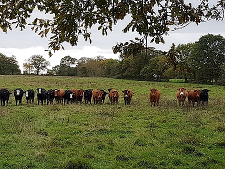
The
cows were curious |
|
|
 |
|
The
River Bollin at the HS2 crossing point |
|
|
|
|
|
|
|
| |
|
|
| |
|
| |
|
Walk 173
- 19/11/17 - Lamaload and Rainow |
| Area |
Cheshire |
Walking time |
3
Hours |
Average speed |
|
| Walk |
Lamaload and Rainow |
Minimum altitude |
|
Maximum altitude |
|
| Start
from |
Rainow |
Altitude loss |
|
Altitude gain |
|
| Weather |
Sunny
periods |
Distance |
7
miles |
|
|
| Map |
Explorer 268 |
Information from
Viewranger app on my Samsung S4 phone |
|
Route - A circular
route from Rainow and passing Lamaload Reservoir |
|
| A
group of our walkers set off from Rainow on a pleasant
walk around Lamaload Reservoir and back to Rainow. Many
thanks to Ray for leading this walk. |
|
|
| |
|
|
|
|
| |
|
|
| |
|
|
| |
|
|
| |
|
| |
|
Walk 174
- 17/12/17 Castleton and Hope from Treak Cliff Cavern |
| Area |
Peak
District |
Walking time |
3
Hours |
Average speed |
|
| Walk |
Castleton and Hope from Treak Cliff Cavern |
Minimum altitude |
|
Maximum altitude |
|
| Start
from |
Treak
Cliff Cavern near Castleton |
Altitude loss |
|
Altitude gain |
|
| Weather |
Drizzle most of the walk |
Distance |
8
miles |
|
|
| Map |
|
Information from
Viewranger app on my Samsung S4 phone |
|
Route - Treak Cliff -
Odin Mine - Knowlegate Farm - Dunscar Farm - Losehill Hall
- Spring House Farm - Killhill Bridge - Hope - Castleton -
Treak Cliff |
|
| Just
three of us braved forecasted poor weather as we donned
our waterproofs and set off from the roadside near Treak
Cliff Cavern. Once on the move we hardly noticed the
drizzle and we passed the Odin Mine and then across the
fields past Knowlegate Farm and Dunscar Farm and then
tracks and lanes took us past Losehill Hall and Spring
Bank Farm. A brief spell of dry weather and a glimpse of
sunshine enabled us to have a coffee stop with good views
across the valley. Then it was onward to Killhill Bridge
and then along the riverside path where we encountered a
large group of 19 walkers from the Wirral. We carried to
Hope where we stopped for lunch in the porch of Hope
Church. Afterwards we followed the riverside path back to
Castleton. Tea and scones were enjoyed in the Cafe and
then it was back up the lane to our cars at the Treak
Cliff Cavern. Many thanks to Kati and Chris R for joining
me on this walk which despite the weather we all enjoyed.
|
|
|
| |
|
|
|
|
| |
|
|
| |
|
|
| |
|
|
| |
|
| |
|
Walk
175 - 31/12/17 Macclesfield Forest and Forest Chapel |
| Area |
Cheshire |
Walking time |
3
hours |
Average speed |
|
| Walk |
Macclesfield Forest and Forest Chapel |
Minimum altitude |
|
Maximum altitude |
|
| Start
from |
Langley |
Altitude loss |
|
Altitude gain |
|
| Weather |
Sunny
periods |
Distance |
7
miles |
|
|
| Map |
Explorer 268 |
Information from
Viewranger app on my Samsung S4 phone |
|
Route Leathers Smithy
- Ridgegate Reservoir - Nessit Hill - Ferriser - Forest
Chapel - Macclesfield Forest - Leathers Smithy |
|
| This
was the last walk of the year for Broken Cross Walkers and
ten of us set off from Leathers Smithy near Langley after
eventually finding parking places which proved to be
rather more difficult than expected. We walked round
the Ridgegate Reservoir and then after crossing the lane
we entered the main forest and walked up to Nessit Hill
where we stopped for coffee with some great views across
the Cheshire Plain and over the Airport to Manchester and
beyond. We then followed the track through the forest
passing the derelict Ferriser Farm and onward to the
Standing Stones Car Park. We then followed the lane
for about ½mile to Forest Chapel where we stopped for
lunch. A lovely place originally constructed in 1673.
Afterwards we walked up Charity Lane, an ancient pack
horse route and then into the forest and along the track
which eventually brought us down to lane close to our
start at the Leathers Smithy. Many thanks to everyone who
came along on our last walk of the year. They were. David,
Christine, Kati, Carolyn, Susanna, Maureen, Derek, Rob,
Alec and Christine. |
|
|
| |
|
|
|
|
| |
|
Macclesfield_Forest on Wikipedia
|
| |
|
|
| |
|
|
| |
|
| |
| |
| |
| |
| |
| |
| |
| |
| |
| |
| |
| |
| |
| |
|
