| |
|
Walk 258 - 09/01/2022 - Macclesfield Forest and Forest Chapel |
| Area |
Cheshire |
Distance |
6.7 miles |
Ascent |
1256 ft |
| Walk |
Macclesfield Forest and Forest Chapel |
Maximum altitude |
1407 ft |
Minimum altitude |
653 ft |
| Start
from |
Langley |
Post |
code |
SK11
0NB |
Duration including
stops |
4 hrs |
|
|
|
what3words |
https://w3w.co/engage.canine.toasters |
Weather |
Sunny periods |
| Map |
Explorer 268
Link to map of start of the walk |
Information from Viewranger app on my Samsung A41 phone |
|
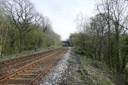
Route - Langley -
Gritstone Trail - Nessit Hill - Ferriser - Standing Stone
- Forest Chapel - Dimples - Clough House - Langley |
|
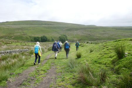
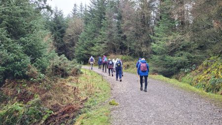
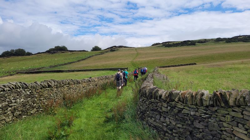
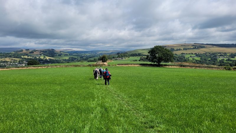
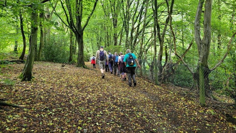
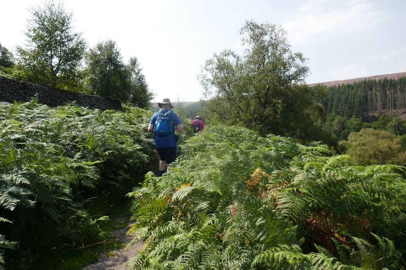
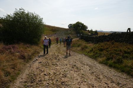
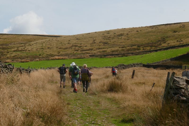
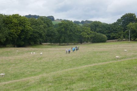
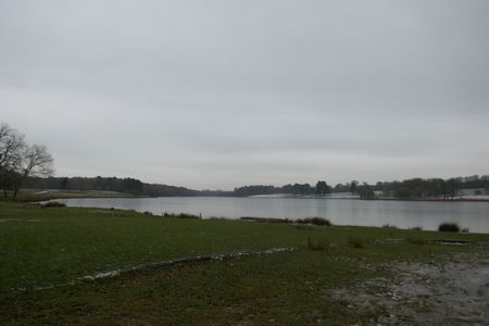
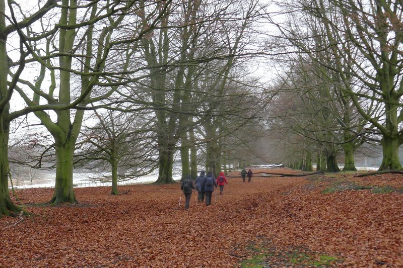
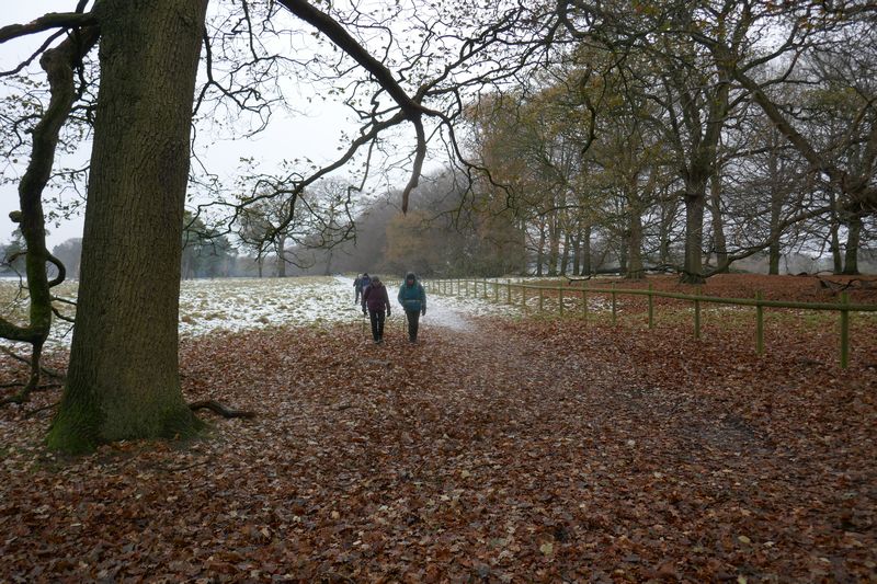
| Ten
of us set off from the car park at Teggsnose Reservoir and
joined the Gritstone Trail for a short way and then took
the forest track up to Nessit Hill where we stopped for a
coffee break. Then it was along the track past the ruined
Ferriser Farmhouse and onto the lane by Standing Stone. We
followed the lane up to Forest Chapel where we stopped for
lunch and then continued on through the forest and joined
the packhorse route down to Clough House. An easy path
then took us along to Teggs Nose Reservoir and the start
of the walk. A walk of almost seven miles with some great
views. Thanks to everyone for coming along on this our
first walk of 2022. Our group were Anita, Judith, Kathryn
Hans, Alan, Karen, David I, Jo, Shirley and David P our
leader. |
|
|
 |
|
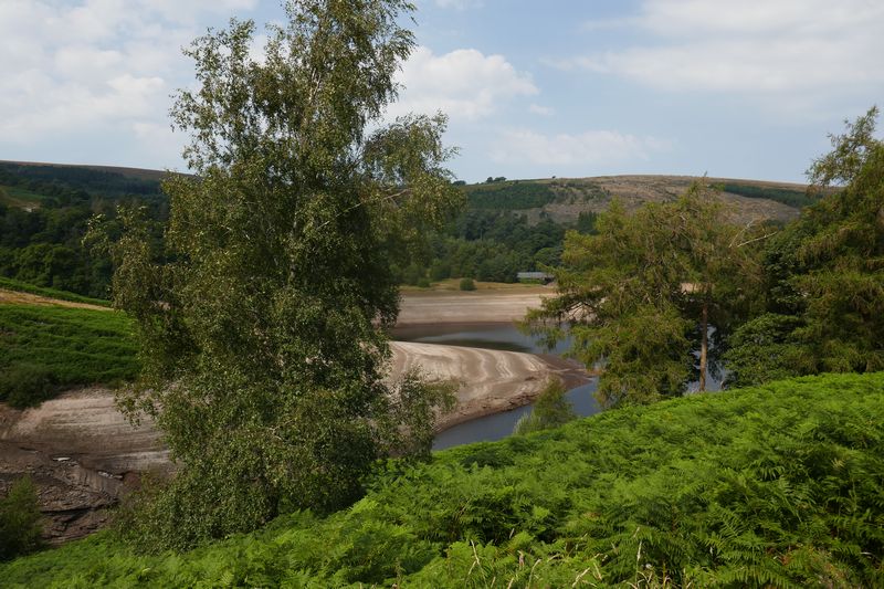
Looking out from
Nessit Hill towards Teggs Nose |
|
|
 |
|
Heading down the old
packhorse route with Teggs Nose on the right |
| |
|
|
 |
|
Heading up to Nessit Hill |
|
|
 |
|
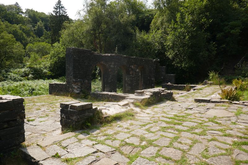
Heading towards the ruined Dimples Farmhouse |
|
|
|
|
|
|
|
|
|
|
|
|
|
|
|
|
|
|
|
|
|
|
|
| |
|
|
|
|
| |
|
| |
|
Walk 259 - 23/01/2022 - Danebridge and Turners Pool |
| Area |
Staffordshire |
Distance |
7.20 miles |
Ascent |
122- ft |
| Walk |
Danebridge and Turners Pool |
Maximum altitude |
1191 ft |
Minimum altitude |
535 ft |
| Start
from |
Danebridge |
Post |
code |
SK11 0QE |
Duration including
stops |
4½ hrs |
|
|
|
what3words |
https://w3w.co/chestnuts.script.pepper |
Weather |
Overcast |
| Map |
Explorer 268 |
Information from Viewranger app on my Samsung A41 phone |
|
Route - Danebridge -
Snipe - Clough Head - Turners Pool - Old Hag - Gun End -
Hollin Hall - Gig Hall - Dane Bridge |
|
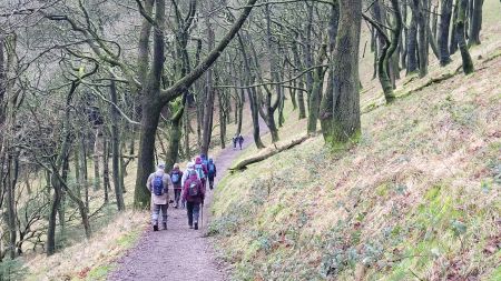
|
Eleven us set from Danebridge and crossed the fields
to Snipe and then along the track past Park House, the
path then took us along the hillside where we
stopped for a coffee break then it was down the lane to
Buxton Brow Farm and across the fields to Turners Pool,
after passing the pool we climbed the hillside stopping
for lunch on the way.
Aftewards we passed
Old Hag and Cliff and into a wood and along one of the
muddiest footpaths we have been down for along
time. Thankfully we emerged onto the road without anyone
slipping and it was nice to walk on tarmac for a bit of
respite from the mud. We then walked down the track
past Hollinhall and Gig Hall and joined the Dane Valley
Way for the walk back to the start at Danebridge. An
interesting walk with mist and mud and some good tracks in
between.
Many thanks to
everyone for coming along on the walk. Our group
consisted of Anita, Ken, Dave I, Judith, Irene, Kath,
Eileen, Marilyn, Alan, Graham and David P our leader. |
|
|
| |
|
|
| |
|
|
|
|
 |
|
Heading along the track to Hollinhall and Gig Hall |
|
|
|
|
|
|
|
|
|
|
|
| |
|
|
|
|
| |
|
| |
|
Walk 260 - 06/02/2022 Rushton Spencer and Bosley Minn |
| Area |
Staffordshire |
Distance |
7 miles |
Ascent |
975 ft |
| Walk |
Rushton Spencer and Bosley Minn |
Maximum altitude |
930 ft |
Minimum altitude |
456 ft |
| Start
from |
Rushton Spencer |
Post |
code |
SK11
0QU |
Duration including
stops |
4 hrs 5 mins |
|
|
|
what3words |
https://w3w.co/polar.packet.curable |
Weather |
Overcast, windy |
| Map |
Link to map of start of the
walk |
Information from Viewranger app on my Samsung A41 phone |
|
Route - Rushton
Spencer - Brandy Lee - Hollinhall - Gig Hall - Dumkins -
Hawkslee - Bosley Minn - Lower Minnend - Hug Bridge -
Rushton Spencer. |
|
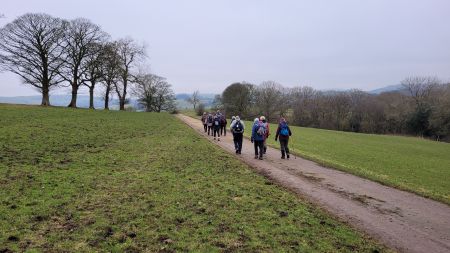
| Eight
of us set off from Rushton Spencer and walked up Sugar
Street and then took the field path past Brandy Lee and
across to Hollinhall, many of the fields were waterlogged
and after much paddling and wading across the wet ground
we emerged onto drier land by Hollinhall where we stopped
for a well earned coffee break. A descent down to Gig Hall
brought us down to the River Dane which was in full flow
with all the recent rain and then the short ascent up to
Whitelee Farm (scene of the infamous murder in 1731, see
link below).
We carried on along
the field paths and tracks to the ruined Dumkins Farm and
here we made a group decision to slightly shorten the walk
due to the time available. We joined the Gritstone Trail
for the walk up to Bosley Minn stopping on the way in a
sheltered and wooded area for lunch. Once on Bosley Minn
we took the lane down past Lower Minnend and crossed the
field to the A523. A short walk down this busy road
brought us to the path along the disused rail track which
took us back to the start at Rushton Spencer.
Many thanks to
everyone for coming along on this walk. Our group
consisted of Anita, Alan, Alec J, Chris J, Dave I,
Marilyn. Jo and David P our leader. |
|
|
|
A little bit of history of the murder at Whitelee Farm, a
tale of “lust, murder and a gruesome hanging” Brough
Family Organization - Brough Crimes (google.com)
|
|
|
| |
|
|
| |
|
|
|
|
| |
|
| |
|
Walk 261 - 06/03/2022 - Peover Superior |
| Area |
Cheshire |
Distance |
8.3 miles |
Ascent |
|
| Walk |
Peover Superior |
Maximum altitude |
|
Minimum altitude |
|
| Start
from |
Peover Superior |
Post |
code |
|
Duration including
stops |
|
|
|
|
what3words |
|
Weather |
Sunny |
| Map |
Explorer 268 |
Information from Viewranger app on my Samsung A41 phone |
|
Route - Peover
Superior - Peover Hall - Freegreen - Radbrooke Hall -
Peover Superior |
|
|
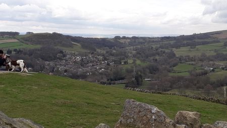
Seven of us set off from Peover Superior on a tour of the
Cheshire plain.
We crossed the fields and went down the track to the 16th
century Peover Hall, originally home of the Mainwarings
and more recently the Peels and then the Brooks. Through
the woods, across the fields and the A50 to a coffee stop.
Then it was onward to Lower Peover, North to Freegreen and
then East along the bridle way to a comfy log on a
'Wicked'' bend for lunch.
Back across the A50 around Radbroke Hall to South Ollerton,
via a water tower and a man-made zoo and South back to the
vehicles.
Around 8.3 miles on a bright and sunny day. Our group
consisted of Alan, Eileen, Irene, Judith, Marilyn and
Wendy with special thanks to David I for leading this
walk.
|
|
|
| |
|
|
| |
|
|
| |
|
|
|
|
| |
|
| |
|
Walk 262 - 20/03/2022 Mottram St Andrew and Alderley Edge |
|
Area |
Cheshire |
Distance |
7 miles |
Ascent |
921 ft |
|
Walk |
Mottram St Andrew & Alderley Edge |
Maximum altitude |
|
Minimum altitude |
|
|
Start from |
Mottram |
|
|
|
Duration including
stops |
|
|
|
|
what3words |
|
Weather |
Sunny
|
|
Map |
Explorer 268 |
Information from Viewranger app on my Samsung S20 FE 5G
phone |
|
Route - Mottram -
Clock House Wood - Dickens Wood - Beacon Hill - Artists
Lane - Findlow Wood - North Cheshire Way - Mottram |
|
|
Eleven of us set off from Mottram and followed the field
path across to Clock House Wood and then followed
the woodland path through Dickens Wood and up to Beacons
Hill stopping en route for a coffee break. We then crossed
the road and a field path took us to Artists Lane and
Bradford Lane with a lunch stop on the way watched by a
friendly horse. Afterwards we continued across the
fields past Finlow and Findlow Wood. After crossing the
Alderley Road we joined the North Cheshire Way to Goose
Green Farm and then back across the fields to the start at
Mottram. Many thanks to everyone for coming along on this
walk around the Cheshire countryside. Our group consisted
of Anita, Judith, Nina, Kathryn, Derek, Eve, David I,
Chris R, Wendy, Alan S and David P our leader. |
|
|
| |
| |
| |
|
|
| |
|
|
| |
|
| |
|
Walk 263 - 03/04/2022 Tower Hill, White Nancy and Kerridge |
|
Area |
Cheshire |
Distance |
7.5 miles |
Ascent |
|
|
Walk |
Tower Hill, White Nancy and Kerridge |
Maximum altitude |
|
Minimum altitude |
|
|
Start from |
Macclesfield, Buxton
Road |
Post code |
SK11 7EP |
Duration including
stops |
4 hours |
|
|
|
what3words |
https://w3w.co/view.camps.woof |
Weather |
Sunshine and snow |
|
Map |
Explorer 268 |
Information from Viewranger app on my Samsung S20 FE 5G
phone |
|
Route - Macclesfield -
Cliff Lane - Bull Hill Lane Lamaload Road - Tower Hill -
White Nancy - Kerridge - Canal - Macclesfield |
|
|
Ten of us set off from Buxton Road towards Cliff
Lane. We crossed the Buxton Road near Bull Hill Lane and
walked through the fields to Lamaload Road and Tower Hill
and then to White Nancy. Then it was down through the wood
into Kerridge and across the fields and onto the canal
towpath for the walk back to Buxton Road. Our group were
Ray, Dave I, Ken, Irene, Wendy Anita, Eve, Marillyn and
Kathryn with many thanks to Judith for leading this
scenic walk with sunshine and snow along the way
|
 |
|
Looking down on
Bollington from White Nancy |
|
|
|
.jpg) |
|
Heading for White
Nancy |
|
|
|
|
.jpg) |
|
Heading along the Ridge |
|
|
|
|
|
|
|
|
|
 |
|
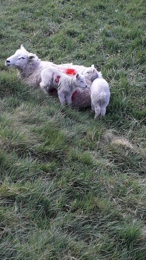
Its
lambing time again |
|
|
|
|
|
|
|
|
|
|
|
| |
|
|
| |
|
| |
|
Walk 264 - 17/04/2022 Poynton and Middlewood with Broken Cross
Walkers |
|
Area |
Cheshire |
Distance |
7.44 miles |
Ascent |
863 ft |
|
Walk |
Poynton and Middlewood with Broken Cross Walkers |
Maximum altitude |
776 ft |
Minimum altitude |
311 ft |
|
Start from |
Poynton Pool |
Post code |
SK12 1BR |
Duration including
stops |
4 hours |
|
|
|
what3words |
https://w3w.co/flaunting.catching.treating |
Weather |
Sunny periods |
|
Map |
Explorer 268 |
Information from Viewranger app on my Samsung S20 FE 5G
phone |
|
Route - Poynton Pool -
Poynton Coppice - Hagg Farm - Green Farm - Platt Wood Farm
- Middlewood - New House Farm - Poynton Pool |
|
|
Nine of us set off from Poynton Pool car park on a nice
sunny day and followed the field paths and tracks across
to Poynton Coppice where we paused for a coffee break and
then it over the Middlewood Way and the Macclesfield Canal
past Hagg Farm and Green Farm.
We joined the North Cheshire Way for a short distance and
then after passing Platt Wood Farm and Middlecale Farm we
arrived back at the Macclesfield Canal where we stopped
for lunch. Afterwards we headed north along the towpath
and then through Middlewood and over the rail track. An
easy walk back across the fields brought us back to the
start at Poynton Pool. A nice scenic walk over just over 7
miles.
Our group consisted of Wendy, Alan, Judith, Jo, Derek,
Dave I, Ray, Chris R and David P
our leader.
|
 |
|
Heading along the
hillside in Lyme Park |
| |
 |
|
The gorse bushes are
looking lovely as we head back to Poynton Pool |
| |
| |
|
|
 |
|
Heading through Poynton Coppice |
|
|
 |
|
Crossing the line after looking both ways |
|
|
|
|
|
|
|
| |
|
|
| |
|
| |
|
Walk 265 - 08/05/2022 Mottram St Andrew and Willot Hall |
|
Area |
|
Distance |
|
Ascent |
|
|
Walk |
|
Maximum altitude |
|
Minimum altitude |
|
|
Start from |
|
|
|
|
Duration including
stops |
|
|
|
|
what3words |
|
Weather |
|
|
Map |
|
Information from Viewranger app on my Samsung S20 FE 5G
phone |
|
Route - |
|
|
|
| |
|
| |
|
Walk 266 - 22/05/2022 Gawsworth and Sutton with Broken
Cross Walkers |
|
Area |
Cheshire |
Distance |
7 |
Ascent |
727 ft |
|
Walk |
Gawsworth and Sutton with Broken Cross Walkers |
Maximum altitude |
|
Minimum altitude |
|
|
Start from |
Gawsworth |
|
|
|
Duration including
stops |
4 hours |
|
|
|
what3words |
Address
https://w3w.co/divided.aunts.executive |
Weather |
Sunny periods |
|
Map |
Explorer 268
Link to map of start of the
walk |
Information from Viewranger app on my Samsung S20 FE 5G
phone |
|
Route - Gawsworth -
Mount Farm - Woodhouse Green Farm - Sutton Reservoir -
Sutton Village - Macclesfield Canal - Danes Moss -
Gawsworth |
|
|
Seventeen of us set
off from Gawsworth and took the track and field paths to
Mount Farm. A walk along the lane took us to Woodhouse
Green Farm and then across the field to the Macclesfield
Canal. we crossed the canal and main road and walked
up the track to Sutton Reservoir where we stopped
for a coffee break. Afterwards we walked through the woods
and across the fields to Sutton Village.
We passed through the
village and more paths took us to Sutton Hall and
onto the canal towpath which we followed to
Danes Moss where we stopped for lunch. After our
refreshments we crossed Danes Moss and the more field
paths, tracks and quiet lanes eventually brought us back
to the start ay Galsworthy Church.
Many thanks to
everyone for coming along on this scenic and flat seven
mile walk.
Our group consisted of
Hans, Anita, Kati, Kath B, Steve, Irene, Dave I, Alan,
Marilyn, Derek, Ray, Sue P, Eileen, Susan M, Nina, Jo and
David P our leader |
|
|
| |
| |
| |
|
|
| |
|
|
| |
|
| |
|
Walk 267 - 05/06/2022 Rushton Spencer and Rudyard Lake |
|
Area |
Staffordshire |
Distance |
7 miles |
Ascent |
666 ft |
|
Walk |
Rushton Spencer and Rudyard Lake |
Maximum altitude |
|
Minimum altitude |
|
|
Start from |
Rushton Spencer |
Post code |
SK11 0QU |
Duration including
stops |
|
|
|
|
what3words |
https://w3w.co/polar.packet.curable
|
Weather |
Rain, heavy at times |
|
Map |
Explorer 268 |
Information from Viewranger app on my Samsung S20 FE 5G
phone |
|
Route - Rushton
Spencer - Cliff Park - Staffordshire Way - Rudyard -
Disused rail track - Rushton Spencer |
|
| Ten
of us set off from Rushton Spencer on a rather damp
morning and after a easy walk along the disused rail track
we joined the Staffordshire Way which took us up to Cliff
Park where we found some limited shelter from the rain for
our coffee break. We then followed the path along the
hillside through the woods past the Sailing Club to the
car park near the dam. After purchasing drinks from the
Cafe we ate our lunch under cover outside the Cafe.
Afterwards we set off across the dam and joined the
footpath along the rail track as the heavy rain arrived.
We walked back down the path in the rain pausing briefly
for shelter under the bridge. Then it was off again and
onward down the track to the start at the car park. A wet
walk but spirits remained high despite the weather.
Many thanks to
everyone who joined the walk in the rain, they were
Judith, Irene, Dave I, Peter F, Marilyn, Sue P, Una, Kath,
Anita and David P our leader. |
|
|
 |
|
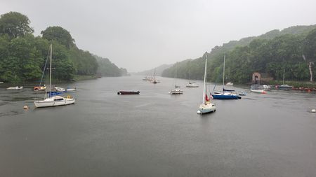
A wet day and not many
boaters out |
|
|
|
 |
|
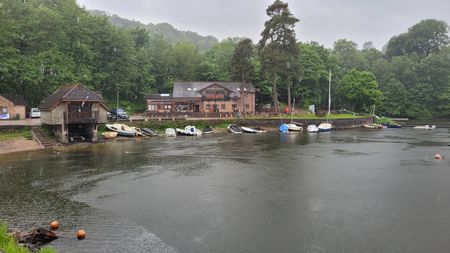
The
Cafe at Rudyard, the water level is low. |
|
|
|
|
|
|
 |
|
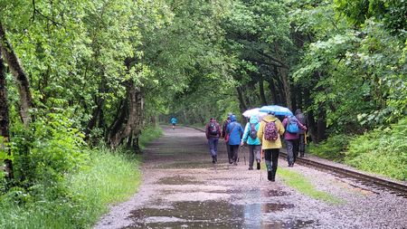
Heading back along the
disused rail track, the brolly's were handy. |
|
| |
|
|
| |
|
| |
|
Walk 268 - 19/06/2022 Wildboarclough and Three Shires Head |
|
Area |
Cheshire |
Distance |
6.8 miles |
Ascent |
1381 ft |
|
Walk |
Wildboarclough and Three Shires Head |
Maximum altitude |
|
Minimum altitude |
|
|
Start from |
Clough Farm,
Wildboarclough |
|
|
|
Duration including
stops |
4 hours |
|
|
|
what3words |
https://w3w.co/sudden.conga.iteration |
Weather |
Sunny periods |
|
Map |
Explorer 268 |
Information from Viewranger app on my Samsung S20 FE 5G
phone |
|
Route - Wildboarclough
- Cumberland Brook - Three Shires Head - Cut thorn -
Bennettshitch - Leech Wood - Crag Hall - Wildboarclough |
|
| Eight of us set off on a rather overcast
day and headed up Cumberland Brook and then after passing
Sparbent and crossing the A54 we paused for a coffee
break, and then descended down the fields to join the Dane
Valley Way which we followed to Three Shires Head.
After a
few photos we carried on along the packhorse route to
Cut-thorn and then joined the lane for the walk to Bennettshitch.
An easy track then took us up the hillside where we
stopped by an old barn for our lunch. Lovely views across
the valley.
Afterwards we
continued up the hillside and across the moor pausing to
examine some rather large slabs hewn from the hillside
rocks. The general consensus was that they may have been
intended to be used as gatepost's but we will probably
never know. We carried on across the moor and after
crossing the A54 again we walked down the lane past Crag
Hall and then Old Post Office.
After crossing the
bridge, the scene of terrible floods in May 1989 we walked up the
hillside track for a fine walk along the hillside and back
to the start at Clough House car park.. Many thanks to
everyone for coming along on the walk, our group consisted
of Alan B, Dave I, Wendy, Marilyn, Kate, Eve, Susan M and
David P our leader. |
|
|
 |
|
Three Shires Head |
|
|
|
|
|
|
|
|
| |
|
|
| |
|
| |
|
Walk 269 - 03/07/2022 Meerbrook and Tittesworth |
|
Area |
Staffordshire |
Distance |
6.8 miles |
Ascent |
702 ft |
|
Walk |
Meerbrook and Tittesworth |
Maximum altitude |
|
Minimum altitude |
|
|
Start from |
Meerbrook |
|
|
|
Duration including
stops |
|
|
|
|
what3words |
|
Weather |
Sunny periods |
|
Map |
Explorer 268 |
Information from Viewranger app on my Samsung S20 FE 5G
phone |
|
Route - Meerbrook -
Staffordshire Moorlands Walk - Soth Hillswood - Wardle
Barn Farm - Springbank Wood - Visitor Centre - Meerbrook |
|
|
Thirteen of us set off from Meerbrook and followed the
waterside path past the sailing club and through
Hinds Clough Wood to South Hillswood Farm. We then
followed the field path down to the River Churnet passing
quite close to the ruins of the 12th century Cisterian
Abbey, we then joined to Churnet Way and after a steep
climb up the hillside we joined the waterside path and
stopped for lunch overlooking the Tittesworth Reservoir
which had a very low water level. After lunch we walked
along the waterside path to the Visitor Centre where most
of us stopped for a coffee in the excellent Cafe.
Afterwards an easy walk back through the village took us
back to the start in Meerbrook Lane.
Many thanks to
everyone who came along on this walk. Our group consisted
of Alan B, Peter F, Ray, Dave I, Peter E, Georgie, Susan
M, Eve, Judith, Irene, Eileen, Kati and David P our
leader. |
|
|
| |
| |
| |
|
|
| |
|
|
| |
|
| |
|
Walk 270 - 17/07/2022 Rainow Scarecrow Walk |
|
Area |
Cheshire |
Distance |
6 miles |
Ascent |
1063 ft |
|
Walk |
Rainow Scarecrow Walk |
Maximum altitude |
1109 ft |
Minimum altitude |
614 ft |
|
Start from |
Higher Hurdsfield |
|
|
|
Duration including
stops |
4 hours |
|
|
|
what3words |
|
Weather |
Very warm Sunny
periods |
|
Map |
Explorer 268 |
Information from Viewranger app on my Samsung S20 FE 5G
phone |
|
Route - Higher
Hurdsfield - Cliff Hill - Marsh Farm - Gritstone Trail -
Tower Hill - Rainow - Kerridge Hill - Swanscoe Hall -
Higher Hurdsfield |
|
| Six
of us set off from Higher Hurdsfield on a very warm day,
we followed the field path over Cliff Hill and after
passing through Marsh Farm we crossed the main Buxton Road
and joined the Gritstone Trail stopping for a coffee break
with some great views across to Rainow. We then carried on
along the field paths and tracks into Rainow where we
stopped for lunch.
Afterwards we
toured around the village looking at the various
Scarecrows that were displayed around the village. We then
set off across the fields and climbed steeply up the side
of Kerridge Hill stopping frequently to rest and admire
the view. We then followed the path down the hill passing
Swanscoe Hall and along Well Lane and back to the start at
Higher Hurdsfield. A scenic walk n a very warm day.
Many thanks to
everyone for coming along on the walk. Our group consisted
of Alan B, Chris R, Dave I, Kati and Margaret W and David
P our leader. |
|
|
| |
| |
| |
|
|
| |
|
|
| |
|
| |
|
Walk 271 - 31/07/2022 Whaley Bridge, Kettleshulme and Taxal |
|
Area |
High Peak |
Distance |
7.4 miles |
Ascent |
1280 ft |
|
Walk |
Whaley Bridge, Kettleshulme and Taxal |
Maximum altitude |
|
Minimum altitude |
|
|
Start from |
Whaley Bridge |
Postcode |
|
SK23 7LX |
Duration including
stops |
4 hours |
|
|
|
what3words |
https://w3w.co/alongside.assure.viewing |
Weather |
Sunny periods |
|
Map |
|
Information from Viewranger app on my Samsung S20 FE 5G
phone |
|
Route - Whaley Bridge
- Slaters Bank - Cliff - Cornfield Farm - Kettleshulme -
Clayton Fold Farm - Taxal - Whaley Bridge |
|
| Nine
of us set off from Whaley Bridge and headed up through
Slaters Bank Wood and then field paths and tracks took us
past Cliff Farm stopping on the way for a coffee break. At
the path junction we headed south and passing Cornfield
Farm and then arrived in Kettleshulme where we stopped for
lunch in the Village playing field.
Afterwards we took
the narrow lane up past Clayton Fold Farm and up onto
Taxal Moor, the path was obscure and after a group
discussion we eventually made our way down to lane and
then down to Taxal Church where we followed the Midshires
Way back into Whaley Bridge. Many thanks to everyone for
coming along on this lovely scenic seven mile walk
walk with mainly sunny periods and the odd shower in the
morning.
Our group consisted
of Ray, Sue P, Chris R, Susan M , Peter J, Dave I,
Jo C, Alan B and David P our leader. |
| |
|
|
|
 |
|
Coffee
break on the hillside |
|
 |
|
Heading
towards Kettleshulme |
|
 |
|
Looking
north from the fields above Kettleshulme |
|
 |
|
Heading
up to Taxal Moor |
|
 |
|
Heading
down to Taxal |
|
 |
|
Heading
along the Midshires Way towards Whaley Bridge |
| |
|
| |
|
| |
|
| |
|
| |
|
| |
|
| |
|
|
| |
|
| |
|
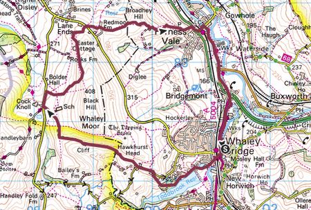
Walk 272 - 14/08/2022 - Goyt Valley and Errwood Hall |
|
Area |
Peak District |
Distance |
6 miles |
Ascent |
358 ft |
|
Walk |
Goyt Valley and Errwood Hall |
Maximum altitude |
|
Minimum altitude |
|
|
Start from |
Goyt Valley, Street
car park |
Postcode |
|
SK17 6GJ |
Duration including
stops |
4 hours |
|
|
|
what3words |
gems.tooth.usuable |
Weather |
Sunny, very warm |
|
Map |
|
Information from Viewranger app on my Samsung S20 FE 5G
phone |
|
Route - Goyt Valley
Street car park - Bunsal Cob - Wild Moor - Goytsclough
Quarry - Errwood Hall - Street car park. |
|
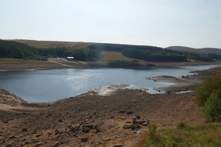
| Five
of us set off from the Goyt Valley Street car park on a
very hot day, we crossed the dam stopping to photograph
the very low water levels and then after passing Bunsal
Cob we entered the forest which gave us some welcome
shade and then stopped for a coffee break on the hillside
with some great views down to the much reduced reservoir.
A hillside path took us along the valley side and then it
was across the River Goyt on the newly repaired Packhorse
Bridge which took us onto the lane and past Goytsclough
Quarry. After a short way along the road we descended down
to the Riverside Walk which gave us some more welcome
shade. Further down the valley we rejoined the road and
took the rising track up though the trees to the grounds
of Errwood Hall where we stopped for lunch shaded by the
trees. Afterwards we arrived at the ruined Hall and spent
a while looking rounds the ruins and then took a decision
to shorten the walk and returned down to the lane which we
followed back to the start at the car park.
Many thanks to
everyone who braved the heat for this six mile walk on
this very hot day. Our group consisted of Dave I Peter C,
Alan B, Peter F and David P our leader |
| |
|
|
|
|
|
|
 |
|
The
rather low water in Errwood Reservoir |
|
|
|
|
|
|
 |
|
Coffee
break on the hillside |
|
 |
|
Heading
through the bracken, its nearly a jungle |
|
 |
|
The
Packhorse Bridge that has just been repaired |
|
 |
|
Heading
through the woods to Errwood Hall |
|
 |
|
The
ruins of Errwood Hall |
|
 |
|
Looking
across to Errwood Reservoir |
|
|
|
|
| |
|
| |
|
| |
|
| |
|
| |
|
| |
|
| |
|
|
| |
|
| |
|
Walk 273 - 28/08/2022 Whaley Bridge and Chinley Churn |
|
Area |
High Peak |
Distance |
8 miles |
Ascent |
1508 ft |
|
Walk |
Whaley Bridge and Chinley Churn |
Maximum altitude |
1482 ft |
Minimum altitude |
469 ft |
|
Start from |
Whaley Bridge |
Postcode |
|
SK23 7NT |
Duration including
stops |
4 hours |
|
|
|
what3words |
https://w3w.co/alongside.assure.viewing |
Weather |
Sunny periods |
|
Map |
OS Peak District OL1
Link to map of start of the walk |
Information from Viewranger app on my Samsung S20 FE 5G
phone |
|
Route - Whaley Bridge
- Waterside - Overhill Road - Chinley Churn - Hollin Wood
- Buxworth - Whaley Bridge |
|
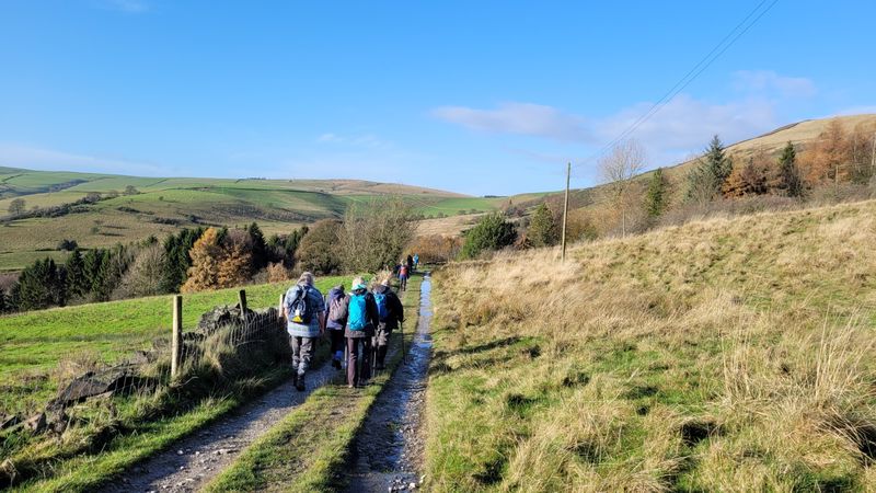
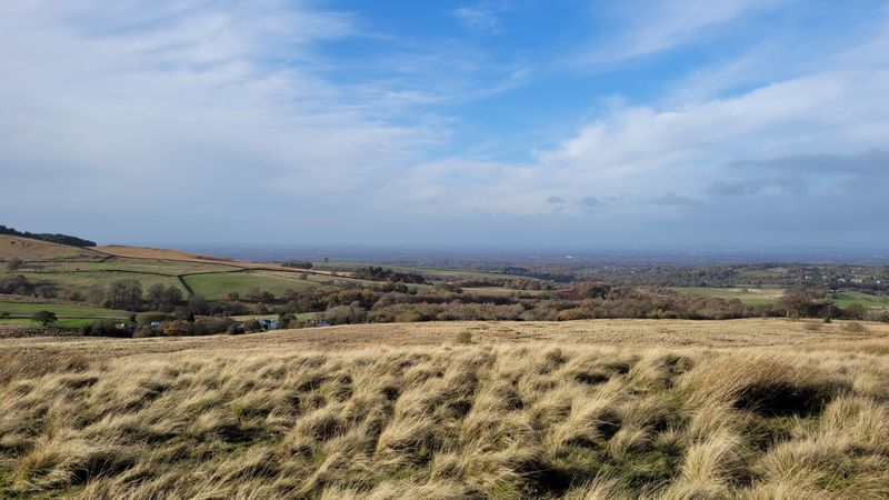
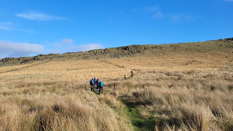
| Fourteen of us set off from Whaley Bridge
and after a short walk alongside the canal we took the
path up to Dolly Lane and then up the hillside path which
turned out to be muddy and overgrown with brambles which
spectacularly tripped up our leader David. We eventually
reached firmer ground and stopped for our coffee break on
the hillside with some great views across the valley. We
then set off through the woods and lost the faint path and
climbed the hillside field to regain out route on Oven
Hill Road. A good bridle path then led us over the moor to
Chinley Churn where we stopped for lunch on the ridge
overlooking the valley with great views over to Kinder
Scout. After lunch we walked along the ridge and Cracken
Edge and through Brierley Green to the canal at Buxworth.
An easy walk back along the canal took us back to the
start at Whaley Bridge. An excellent walk with sunny
periods, great views, a few hills, a bit of mud, plenty of
brambles and excellent coffee and cakes at the end of the
walk. Our
group consisted of Anita, Kati, Dave I, Ray, Judith,
Irene, Sue P, Marilyn, Alan B, Peter F, Jo, Steve R, Kath
and David P our leader |
|
|
| |
| |
| |
|
|
 |
|
Heading along Oven Hill Road, rather stony |
|
|
|
|
 |
|
Looking
along Oven Hill Road |
|
 |
|
Heading
across the moor |
|
 |
|
A steep
pull up to Chinley Churn |
|
 |
|
Lunch
with a view on Chinley Churn, looking across to Kinder Scout |
|
 |
|
Descending from Cracken Edge |
|
|
| |
| |
| |
|
| |
|
| |
|
Walk 274 - 11/09/2022 - Bosley and North Rode |
|
Area |
Cheshire |
Distance |
8 miles |
Ascent |
|
|
Walk |
Bosley and North Rode |
Maximum altitude |
|
Minimum altitude |
|
|
Start from |
Bosley |
|
|
|
Duration including
stops |
|
|
|
|
what3words |
|
Weather |
Sunny periods |
|
Map |
Explorer 268 |
Information from Viewranger app on my Samsung S20 FE 5G
phone |
|
Route - Bosley -
Crossley Stud Farm- North Rode - Stoneyfold - Bosley
Reservoir Bosley |
|
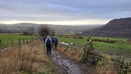
| Twelve of us set off from Bosley and
followed the field paths westwards to Crossley Stud Farm
where we stopped for a coffee break. Then it was along
the A54 for a short distance and then up through the
fields to North Rode. We passed the Church and field
paths, tracks and a quiet lane took us to Bosley Locks
where we stopped for lunch.
Afterwards another stretch
of the quiet lane took us to Stoneyfold with some great
views across to the hills. We crossed the A54 again and a
lovely path took us around the reservoir with a very low
water level and then back into Bosley to the start of the walk.
A walk of almost
eight miles with sunny periods all day. Our group
consisted of Alan B, Dave I, Eileen, Judith, Marilyn,
Chris R, Anita, Jo, Peter F, Kati, Irene and David P our
leader. |
|
|
| |
| |
| |
|
|
| |
|
|
| |
|
| |
|
Walk 275 - 25/09/2022 - Rushton Spencer, Gig Hall and the
Gritstone Trail |
|
Area |
Staffordshire |
Distance |
7 miles |
Ascent |
643 ft |
|
Walk |
Rushton Spencer,
Gig Hall and the Gritstone Trail |
Maximum altitude |
|
Minimum altitude |
|
|
Start from |
Rushton Spencer |
Post Code |
|
SK11 0QU |
Duration including
stops |
4 hours |
|
|
|
what3words |
https://w3w.co/polar.packet.curable |
Weather |
Sunny periods |
|
Map |
Explorer 268 |
Information from Viewranger app on my Samsung S20 FE 5G
phone |
|
Route - Rushton
Spencer - Heaton Hall - Hawkesley Farm - Gig Hall -
Whitelee Farm- Gritstone Trail - Staffordshire Way -
Rushton Spencer |
|
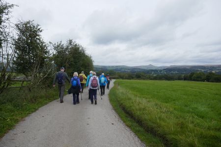
| Eleven
of us set off from Rushton Spencer and followed field
paths and tracks to Heaton where we stopped for our coffee
break, then it was across the fields to Hawksesley Farm
and down the track to Gig Hall where we stopped for our
lunch.
Afterwards we
climbed the field path to Whitelee Farm scene of the
infamous murder of Robert Brough in 1731. WE carried on
across the fields and joined the Gritstone Trail which we
followed back to the outskirts of Rushton. An easy walk
back along the disused railway brought us back to the
start at the car park in Rushton Spencer.
Many thanks to
everyone for coming along on this walk. Our group
consisted of Anita, Alan B, Dave I, Kati, Eileen, Chris J,
Kim, Judith, Irene, Sheila D and David P the leader. |
|
|
|
Link to the story of the Whitelee Murder |
| |
 |
|
Heading towards Heaton |
| |
 |
|
Crossing the field
towards Gig Hall |
| |
| |
| |
| |
| |
| |
|
|
 |
|
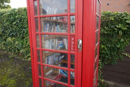
A
good use for a redundant phone box |
|
|
 |
|
On
the track leading to Hollinhall |
|
|
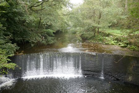 |
|
The
River Dane near Gig Hall |
|
|
|
|
|
|
|
|
|
|
|
| |
|
|
| |
|
| |
|
Walk 276 - 09/10/2022 - Mottram St Andrew and Alderley Edge |
|
Area |
Cheshire |
Distance |
7 miles |
Ascent |
410 ft |
|
Walk |
Mottram St
Andrew and Alderley Edge |
Maximum altitude |
|
Minimum altitude |
|
|
Start from |
Mottram St Andrew |
Post code |
|
|
Duration including
stops |
|
|
|
|
what3words |
|
Weather |
Sunny periods |
|
Map |
Explorer 268 |
Information from Viewranger app on my Samsung S20 FE 5G
phone |
|
Route - Mottram
St Andrew - Clock House Wood - Dickens Wood - Dean Farm -
Mottram Bridge - Mottram Hall - Legh Hall - Mottram St
Andrew |
|
| Nine of us set off from Mottram St Andrew
and headed across the fields to Clock House Wood, and
after a very steep climb up the hillside steps we paused
to catch our breath then it was along the woodland path
and through Dickens Wood to the road where we stopped for
a coffee break. Afterwards we passed through a vast area
of flat fields with many acres of mown hay ready to be
harvested as soon as the weather warmed up. A short
stretch up the road then took us through Dean Farm and
then after a lunch stop we continued on to Mottram Bridge
on the River Bollin. We followed the Bollin Valley Way
along the river bank past Mottram Hall Golf Club and then
across more of the golf course and fields to Legh Hall.
More paths and tracks brought us back to the start at the
School at Mottram St Andrew. A lovely walk in great
weather led by Dave Ilett. The others members of our
group were Alan B, Derek, Marilyn, Jo, Wendy, Irene,
Judith and David P. |
|
|
| |
| |
| |
|
|
| |
|
|
| |
|
| |
|
Walk 277 - 23/10/2022 Circuit of Tittesworth |
|
Area |
Staffordshire |
Distance |
6 miles |
Ascent |
|
|
Walk |
Circuit of
Tittesworth |
Maximum altitude |
|
Minimum altitude |
|
|
Start from |
Meerbrook |
Post Code ST13 8SJ |
Duration including
stops |
4 hours |
|
|
|
what3words |
https://w3w.co/birdcage.hopeless.boats
|
Weather |
Rain then overcast |
|
Map |
Link to map of
start of the walk |
Information from Viewranger app on my Samsung S20 FE 5G
phone |
|
Route -
Meerbrook - Hawthorne Wood - Hindsclough Wood - Dam -
Springbank Wood - Visitor Centre - Meerbrook |
|
|
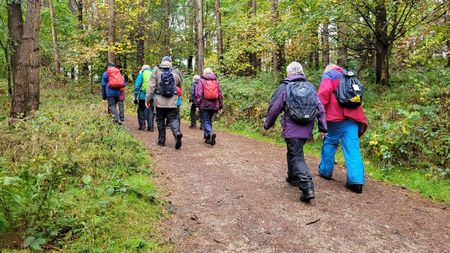
Fifteen of us set off on a rainy morning for a walk around
Tittesworth Reservoir. We followed the lane for a short
distance then joined the waterside path and headed through
the woods to the dam where we stopped for a coffee break
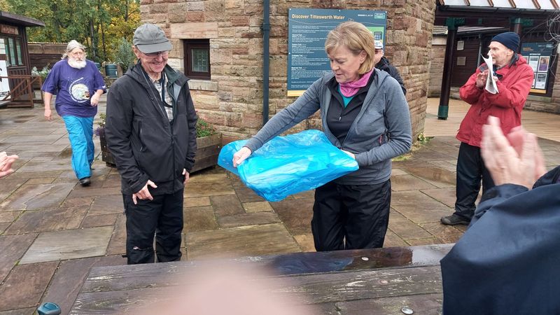
as the rain had ceased. As it was David's 80th birthday in
a few days he produced some excellent cakes which we ate
before continuing on along the path to the Visitor Centre.
Once at the Centre refreshments were purchased and we were
able to eat our lunch on the picnic benches. Much to
David's surprise he was presented with some gifts from the
members of the group to celebrate his 80th Birthday and
the 12 years of walking that we have all enjoyed since the
Group was formed.
David thanked the Walkers for the presents and for coming
along on the walks in the past and helping to make the
Group the success it has been . A short walk back through
the village brought us back to the start on the edge of
the Village.
Many thanks to everyone who came along on the walk, they
were Dave I, Ray, Alan B, Janet, Bill, Judith, Irene,
Wendy, Alan S, Susanna, Sheila D, Marilyn, Rita, Chris R
and the leader was David, also a big thank you to everyone
who contributed to the wonderful gifts presented to
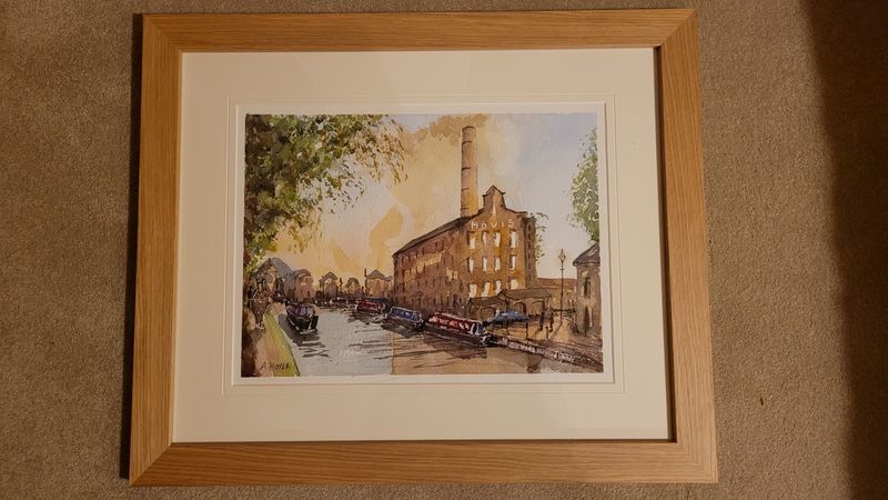
David, the beautiful painting will take pride of place on
my wall, the book token will definitely be put to good use
for maps and walking books and the Voucher for Afternoon
Tea will be greatly enjoyed by Christine and I.
|
|
|
| |
| |
| |
|
|
 |
|
Heading through the woods towards the Dam |
 |
|
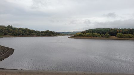
The
water level in the Reservoir is low |
|
|
|
|
|
| |
|
|
.jpg) |
|
Coffee
and cake at the Dam |
|
 |
|
The
presentation |
|
 |
|
The
painting of Hovis Mill |
| |
|
| |
|
|
| |
|
| |
|
Walk 278 - 06/11/2022 - Rushton Spemcer and Woodhouse Green |
|
Area |
Staffordshire |
Distance |
6 miles |
Ascent |
|
|
Walk |
Rushton Spencer
and Woodhouse Green |
Maximum altitude |
|
Minimum altitude |
|
|
Start from |
Rushton Spencer |
Post Code SK11 0QU |
Duration including
stops |
4 hours |
|
|
|
what3words |
https://w3w.co/polar.packet.curable |
Weather |
Overcast |
|
Map |
Explorer 268
Click for link to start of the
walk |
Information from Viewranger app on my Samsung S20 FE 5G
phone |
|
Route - Rushton
Spencer - Wallhill - Holmlea - Woodhouse Green - Great
Hough - Rushton Spencer |
|
|
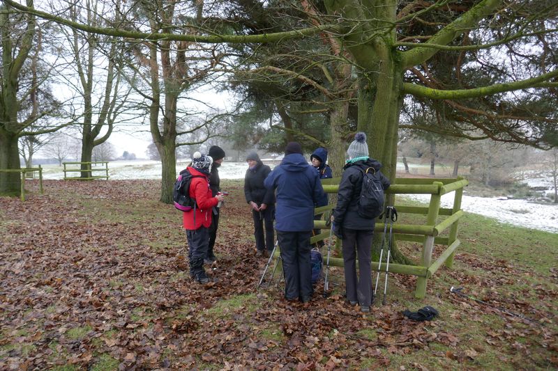
Walk report Sunday 6th November Rushton
Spencer
Six of us set off in dryish conditions and
crossed the A523, up Tanhouse Lane then turned along the
Conduit to Wallhill, then back over the A523, under the
old railway and up to Holmlea where we had coffee.
Then on to Woodhouse Green, Ditchway Farm,
Oulton and to lunch with a slowly fading view at Lane End.
Along Beat Lane, then on the footpath to Fold farm, Great
Hough, and over the fields to the old railway and back to
the vehicles in fetish conditions.
Our group consisted of Alan, Anita, Eileen,
Judith, Peter F and many thanks to Dave Ilett for leading
this 6 mile walk.
|
|
|
| |
| |
| |
|
|
| |
|
|
| |
|
| |
|
Walk 279 - 20/11/2022 Whaley Bridge and Whaley Moor |
|
Area |
High Peak |
Distance |
7 miles |
Ascent |
774 ft |
|
Walk |
Whaley Bridge and Whaley Moor |
Maximum altitude |
|
Minimum altitude |
|
|
Start from |
Whaley Bridge |
Post Code
SK23 7NT |
Duration including
stops |
4 hours |
|
|
|
what3words |
https://w3w.co/alongside.assure.viewing |
Weather |
Sunny periods |
|
Map |
Link to map of start of the walk |
Information from Viewranger app on my Samsung S20 FE 5G
phone |
|
Route - Whaley
Bridge - Toddbrook Reservoir - Slatersbank Wood - Cliff -
Cock Knoll - Whaley Moor - Kiln Knoll - Furness Vale -
Whaley Bridge |
|
|
Nine of us set off
from Whaley Bridge on a sunny day . and followed the lane
alongside Toddbrook Reservoir and then up through
Slatersbank Wood and along the hillside to Cliff stopping
on the way for a coffee break with some great views across
the valley towards Kettlsehulme.
Afterwards field
paths and tracks took us to Mudhurst Lane and then some
confusing footpaths signs we climbed the hillside to Black
Hill to be rewarded with some great views across to Lyme
Park in the west and Kinder Scout in the east.
We crossed Whaley
Lane and stopped for lunch in a sheltered place and then
after passing Kiln Knoll we headed down to Furness Vale
and joined the Peak Forest Canal for the walk back to
Whaley Bridge as it became overcast. A seven mile walk
with some great views and nice sunny weather for most of
the day.
The forecasted
showers did not arrive until we were safely back in the
cars and on our way home.
Thanks to everybody
who came along on the walk. Our group were Alec, Chris J,
Susan M, Eve, Dave I, Anita, Marilyn, Chris R and David P
our leader.
|
|
|
 |
|
Map
of our route |
|
|
|
| |
|
|
 |
|
Heading
along the hillside towards Cliff |
|
 |
|
Looking
across towards Lyme Park with The Cage just visible |
|
 |
|
Heading
up twoards Whaley Moor |
| |
| |
| |
|
| |
| |
| |
| |
| |
| |
| |
| |
| |
| |
|
| |
|
Walk 280 - 04/12/2022 Gawsworth and North Rode |
|
Area |
Cheshire |
Distance |
7 miles |
Ascent 230ft |
230 ft |
|
Walk |
Gawsworth and North Rode |
Maximum altitude |
|
Minimum altitude |
|
|
Start from |
Gawsworth |
Post Code SK11 9RJ |
Duration including
stops |
4 hours |
|
|
|
what3words |
https://w3w.co/divided.aunts.executive |
Weather |
Overcast |
|
Map |
Link to map of start of the walk |
Information from Viewranger app on my Samsung S20 FE 5G
phone |
|
Route - Gawsworth
- Cloverbank Farm - Manor Farm - Bosley Locks -
Macclesfield Canal - Fodens Farm - New Hall - Gawsworth
Church |
|
|
Twelve of us set off
from Gawsworth Church and took the field paths across to
North Rode, stopping for a coffee break on the way. We
passed North Rode Church and followed the track and lane
to Bosley Locks where we stopped for lunch.
Afterwards we
continued north along the towpath and across the field to
Fodens Farm and then a short walk along the lane
brought us to the field path which took us to the
Gawsworth and beautiful Medieval Church where we stopped
to visit the Christmas Tree Festival in the Church.
An excellent
display of illuminated trees with many hand made gifts for
sale in aid of Church Funds. Our group consisted of
Judith, Wendy, Marilyn, Jo, Dave I, Bill, Janet, Susan,
Eve, Susanna, Ray and David P our walk leader. |
|
|
| |
| |
| |
|
|
| |
|
|
| |
|
| |
|
Walk 281 - 18/12/2022 - Tatton Park from Knutsford |
|
Area |
Cheshire |
Distance |
6 miles |
Ascent |
165 ft |
|
Walk |
Tatton Park from Knutsford |
Maximum altitude |
|
Minimum altitude |
|
|
Start from |
Knutsford |
Post Code
WA16 6DF |
Duration including
stops |
4 hours |
|
|
|
what3words |
https://w3w.co/swordfish.revisit.tensions |
Weather |
Overcast, Icy
footpaths |
|
Map |
Explorer 268
Link to map of start of the walk |
Information from Viewranger app on my Samsung S20 FE 5G
phone |
|
Route - Knutsford
- Dog Wood - Tatton Mere - Old Hall - Deer Park -Tatton
Courtyard -The Temple - Beech Avenue - Knutsford |
|
|
Seven of us set off from Knutsford and entered Tatton Park
through Dog Wood, icy paths slowed our progress and great
care was needed throughout the walk. We followed the track
across the park only to thwarted by a missing bridge over
the stream. It was there last time we came this way.
We followed the stream
up to the road to cross and then after passing the Old
Hall we stopped for a coffee break in some trees for
shelter. Then it was across the Deer Park and through the
trees to the Courtyard and into the Cafe where we ate our
lunch with coffee and cake purchased from Cafe.
Afterwards we
walked past the Hall entrance and as the ground was very
icy we walked back to Knutsford along the Beech Avenue
which was ice free. A good six mile walk which we managed
to complete without any trips or tumbles on the icy
paths.
Many thanks to
everyone for coming along on this our last walk of the
year. Our group consisted of Wendy, Judith, Jo,
Susan, Eve, Kate and David P our leader |
|
|
|
|
 |
|
Tatton Mere |
|
|
|
| |
|
|
 |
|
Coffee
break |
|
 |
|
Heading
down the Beech Avenue |
|
 |
|
Approaching the end of the walk |
| |
| |
| |
|
| |
|
| |
|
Many thanks
to everyone who has come along on the walks this year. We have
completed 24 walks this year and walked over 170 miles |
| |
|
A Merry Christmas and a
Happy New Year to everyone and Best Wishes for 2023 |
| |
| |
|